You are here: Home > Network List > US - United States National Seismic Network Stations List
> Station HAWA Hanford, Washington, USA > Earthquake Result Viewer
HAWA Hanford, Washington, USA - Earthquake Result Viewer
*The percent match for this event was below the threshold and hence no stack was calculated.
| Earthquake location: |
Near Coast Of Venezuela |
| Earthquake latitude/longitude: |
10.9/-62.3 |
| Earthquake time(UTC): |
2013/10/12 (285) 02:10:27 GMT |
| Earthquake Depth: |
63 km |
| Earthquake Magnitude: |
6.0 MWW, 6.0 MWW, 6.0 MWB, 6.0 MWC, 6.0 MI |
| Earthquake Catalog/Contributor: |
NEIC PDE/NEIC COMCAT |
|
| Network: |
US United States National Seismic Network |
| Station: |
HAWA Hanford, Washington, USA |
| Lat/Lon: |
46.39 N/119.53 W |
| Elevation: |
364 m |
|
| Distance: |
59.8 deg |
| Az: |
317.653 deg |
| Baz: |
107.081 deg |
| Ray Param: |
$rayparam |
*The percent match for this event was below the threshold and hence was not used in the summary stack. |
|
| Radial Match: |
66.90394 % |
| Radial Bump: |
400 |
| Transverse Match: |
81.970345 % |
| Transverse Bump: |
400 |
| SOD ConfigId: |
626651 |
| Insert Time: |
2014-04-19 01:56:35.196 +0000 |
| GWidth: |
2.5 |
| Max Bumps: |
400 |
| Tol: |
0.001 |
|
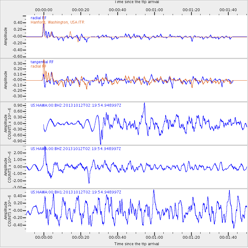
Signal To Noise
| Channel | StoN | STA | LTA |
| US:HAWA:00:BHZ:20131012T02:19:54.948997Z | 6.5198393 | 1.2338435E-6 | 1.8924446E-7 |
| US:HAWA:00:BH1:20131012T02:19:54.948997Z | 2.3615065 | 1.73278E-7 | 7.337604E-8 |
| US:HAWA:00:BH2:20131012T02:19:54.948997Z | 3.5636535 | 4.5846252E-7 | 1.2864957E-7 |
| Arrivals |
| Ps | |
| PpPs | |
| PsPs/PpSs | |


