TLY Talaya, Russia - Earthquake Result Viewer
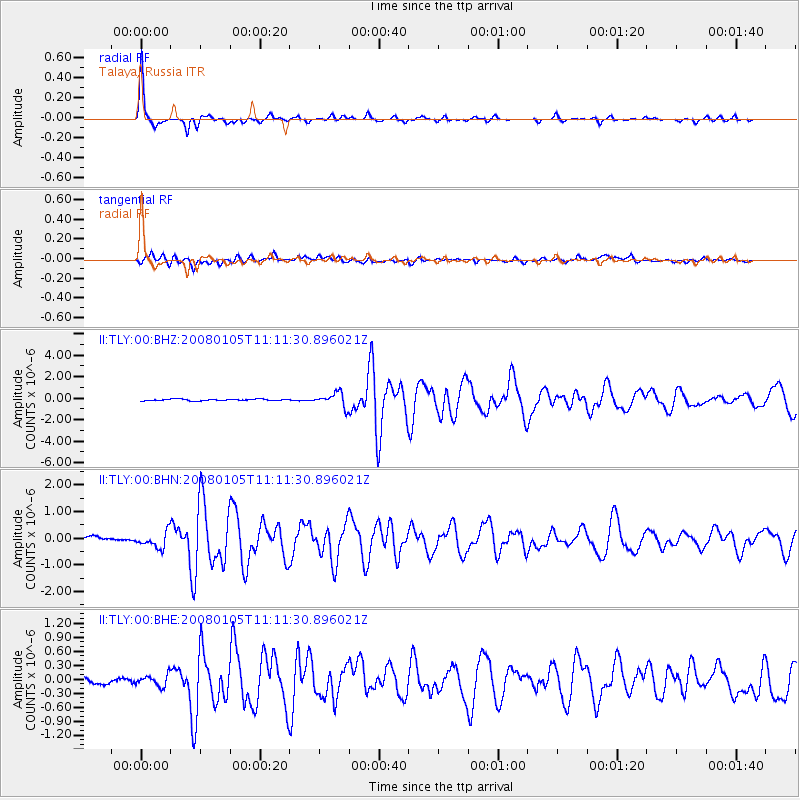
Earthquake location: Queen Charlotte Islands Region
Earthquake latitude/longitude: 51.3/-130.8
Earthquake time(UTC): 2008/01/05 (005) 11:01:05 GMT
Earthquake Depth: 10 km
Earthquake Magnitude: 6.0 MB, 6.5 MS, 6.6 MW, 6.6 MW
Earthquake Catalog/Contributor: WHDF/NEIC
Network: II Global Seismograph Network (GSN - IRIS/IDA)
Station: TLY Talaya, Russia
Lat/Lon: 51.68 N/103.64 E
Elevation: 579 m
Distance: 67.6 deg
Az: 326.803 deg
Baz: 33.543 deg
Ray Param: 0.056848288
Estimated Moho Depth: 16.25 km
Estimated Crust Vp/Vs: 1.60
Assumed Crust Vp: 6.419 km/s
Estimated Crust Vs: 4.006 km/s
Estimated Crust Poisson's Ratio: 0.18
Radial Match: 97.40247 %
Radial Bump: 256
Transverse Match: 86.151054 %
Transverse Bump: 400
SOD ConfigId: 2564
Insert Time: 2010-03-01 17:18:49.611 +0000
GWidth: 2.5
Max Bumps: 400
Tol: 0.001

Signal To Noise

ChannelStoNSTALTA
II:TLY:00:BHN:20080105T11:11:30.896021Z3.1049182.9138397E-79.384595E-8
II:TLY:00:BHE:20080105T11:11:30.896021Z1.5907831.2067422E-77.5858374E-8
II:TLY:00:BHZ:20080105T11:11:30.896021Z8.8932136.603847E-77.425716E-8
Arrivals
Ps1.6 SECOND
PpPs6.3 SECOND
PsPs/PpSs7.9 SECOND