You are here: Home > Network List > G - GEOSCOPE Stations List
> Station MPG Montagne des Peres, French Guyana > Earthquake Result Viewer
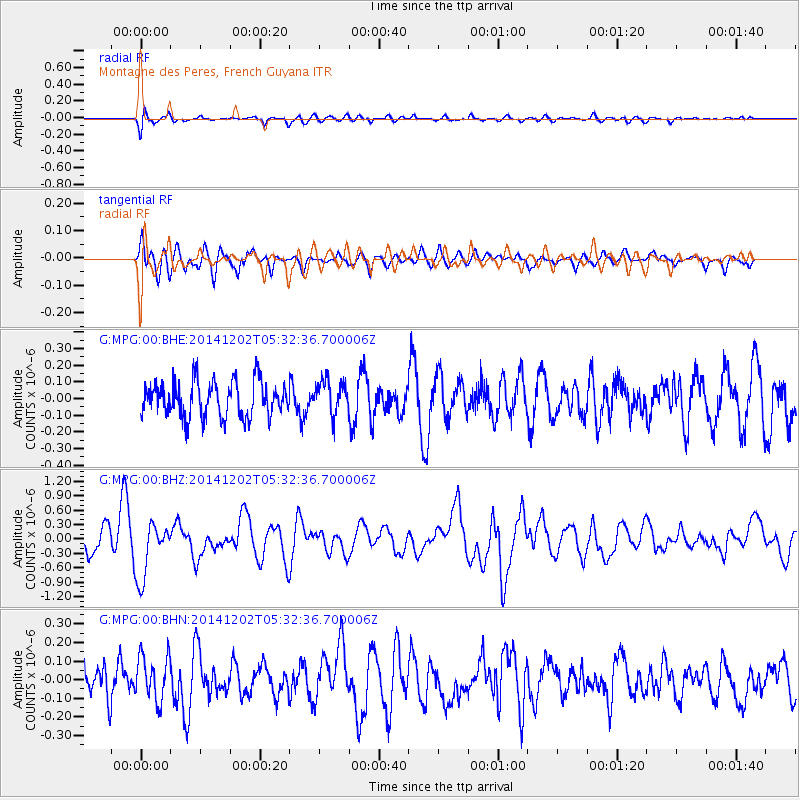
MPG Montagne des Peres, French Guyana - Earthquake Result Viewer
*The percent match for this event was below the threshold and hence no stack was calculated.
| Earthquake location: |
Southeast Of Galapagos Islands |
| Earthquake latitude/longitude: |
-6.2/-86.9 |
| Earthquake time(UTC): |
2014/12/02 (336) 05:26:53 GMT |
| Earthquake Depth: |
574 km |
| Earthquake Magnitude: |
5.5 MW |
| Earthquake Catalog/Contributor: |
ISC/ISC |
|
| Network: |
G GEOSCOPE |
| Station: |
MPG Montagne des Peres, French Guyana |
| Lat/Lon: |
5.11 N/52.64 W |
| Elevation: |
147 m |
|
| Distance: |
36.0 deg |
| Az: |
72.584 deg |
| Baz: |
252.255 deg |
| Ray Param: |
$rayparam |
*The percent match for this event was below the threshold and hence was not used in the summary stack. |
|
| Radial Match: |
55.44198 % |
| Radial Bump: |
400 |
| Transverse Match: |
51.068127 % |
| Transverse Bump: |
400 |
| SOD ConfigId: |
3390531 |
| Insert Time: |
2019-04-15 07:24:55.692 +0000 |
| GWidth: |
2.5 |
| Max Bumps: |
400 |
| Tol: |
0.001 |
|
Signal To Noise
| Channel | StoN | STA | LTA |
| G:MPG:00:BHZ:20141202T05:32:36.700006Z | 3.2871463 | 5.860558E-7 | 1.7828711E-7 |
| G:MPG:00:BHN:20141202T05:32:36.700006Z | 1.2742323 | 1.2063299E-7 | 9.4671115E-8 |
| G:MPG:00:BHE:20141202T05:32:36.700006Z | 0.9429083 | 1.0035764E-7 | 1.0643414E-7 |
| Arrivals |
| Ps | |
| PpPs | |
| PsPs/PpSs | |


