You are here: Home > Network List > IU - Global Seismograph Network (GSN - IRIS/USGS) Stations List
> Station JOHN Johnston Island, USA > Earthquake Result Viewer
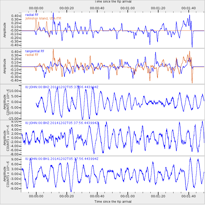
JOHN Johnston Island, USA - Earthquake Result Viewer
*The percent match for this event was below the threshold and hence no stack was calculated.
| Earthquake location: |
Southeast Of Galapagos Islands |
| Earthquake latitude/longitude: |
-6.2/-86.9 |
| Earthquake time(UTC): |
2014/12/02 (336) 05:26:53 GMT |
| Earthquake Depth: |
574 km |
| Earthquake Magnitude: |
5.5 MW |
| Earthquake Catalog/Contributor: |
ISC/ISC |
|
| Network: |
IU Global Seismograph Network (GSN - IRIS/USGS) |
| Station: |
JOHN Johnston Island, USA |
| Lat/Lon: |
16.73 N/169.53 W |
| Elevation: |
2.0 m |
|
| Distance: |
84.7 deg |
| Az: |
287.394 deg |
| Baz: |
98.026 deg |
| Ray Param: |
$rayparam |
*The percent match for this event was below the threshold and hence was not used in the summary stack. |
|
| Radial Match: |
45.147293 % |
| Radial Bump: |
365 |
| Transverse Match: |
53.876938 % |
| Transverse Bump: |
400 |
| SOD ConfigId: |
3390531 |
| Insert Time: |
2019-04-15 07:26:12.389 +0000 |
| GWidth: |
2.5 |
| Max Bumps: |
400 |
| Tol: |
0.001 |
|
Signal To Noise
| Channel | StoN | STA | LTA |
| IU:JOHN:00:BHZ:20141202T05:37:56.443994Z | 0.8536458 | 1.9007381E-6 | 2.2266122E-6 |
| IU:JOHN:00:BH1:20141202T05:37:56.443994Z | 0.6780333 | 3.1057539E-6 | 4.5805327E-6 |
| IU:JOHN:00:BH2:20141202T05:37:56.443994Z | 1.3540355 | 9.424637E-6 | 6.9604057E-6 |
| Arrivals |
| Ps | |
| PpPs | |
| PsPs/PpSs | |


