You are here: Home > Network List > CI - Caltech Regional Seismic Network Stations List
> Station TIN Tinemaha, Big Pine, CA, USA > Earthquake Result Viewer
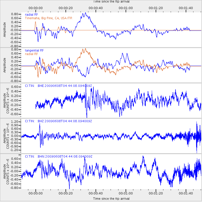
TIN Tinemaha, Big Pine, CA, USA - Earthquake Result Viewer
*The percent match for this event was below the threshold and hence no stack was calculated.
| Earthquake location: |
South Of Fiji Islands |
| Earthquake latitude/longitude: |
-22.2/-179.6 |
| Earthquake time(UTC): |
2009/06/08 (159) 04:33:19 GMT |
| Earthquake Depth: |
612 km |
| Earthquake Magnitude: |
5.5 MW, 5.2 MB |
| Earthquake Catalog/Contributor: |
WHDF/NEIC |
|
| Network: |
CI Caltech Regional Seismic Network |
| Station: |
TIN Tinemaha, Big Pine, CA, USA |
| Lat/Lon: |
37.05 N/118.23 W |
| Elevation: |
1197 m |
|
| Distance: |
82.6 deg |
| Az: |
45.09 deg |
| Baz: |
235.108 deg |
| Ray Param: |
$rayparam |
*The percent match for this event was below the threshold and hence was not used in the summary stack. |
|
| Radial Match: |
36.6897 % |
| Radial Bump: |
400 |
| Transverse Match: |
39.691853 % |
| Transverse Bump: |
400 |
| SOD ConfigId: |
2648 |
| Insert Time: |
2010-02-25 20:52:51.463 +0000 |
| GWidth: |
2.5 |
| Max Bumps: |
400 |
| Tol: |
0.001 |
|
Signal To Noise
| Channel | StoN | STA | LTA |
| CI:TIN: :BHZ:20090608T04:44:08.094009Z | 3.4150484 | 4.0324383E-7 | 1.1807852E-7 |
| CI:TIN: :BHN:20090608T04:44:08.094009Z | 1.4455404 | 2.8564034E-7 | 1.9760107E-7 |
| CI:TIN: :BHE:20090608T04:44:08.094009Z | 2.1657443 | 3.0461518E-7 | 1.406515E-7 |
| Arrivals |
| Ps | |
| PpPs | |
| PsPs/PpSs | |


