You are here: Home > Network List > US - United States National Seismic Network Stations List
> Station HDIL Hopedale, Illinois, USA > Earthquake Result Viewer
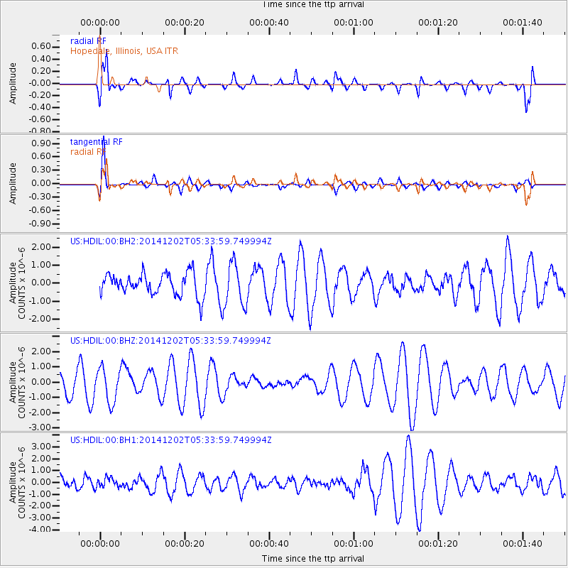
HDIL Hopedale, Illinois, USA - Earthquake Result Viewer
*The percent match for this event was below the threshold and hence no stack was calculated.
| Earthquake location: |
Southeast Of Galapagos Islands |
| Earthquake latitude/longitude: |
-6.2/-86.9 |
| Earthquake time(UTC): |
2014/12/02 (336) 05:26:53 GMT |
| Earthquake Depth: |
574 km |
| Earthquake Magnitude: |
5.5 MW |
| Earthquake Catalog/Contributor: |
ISC/ISC |
|
| Network: |
US United States National Seismic Network |
| Station: |
HDIL Hopedale, Illinois, USA |
| Lat/Lon: |
40.56 N/89.29 W |
| Elevation: |
219 m |
|
| Distance: |
46.6 deg |
| Az: |
357.506 deg |
| Baz: |
176.745 deg |
| Ray Param: |
$rayparam |
*The percent match for this event was below the threshold and hence was not used in the summary stack. |
|
| Radial Match: |
83.765434 % |
| Radial Bump: |
400 |
| Transverse Match: |
83.872154 % |
| Transverse Bump: |
400 |
| SOD ConfigId: |
3390531 |
| Insert Time: |
2019-04-15 07:29:18.015 +0000 |
| GWidth: |
2.5 |
| Max Bumps: |
400 |
| Tol: |
0.001 |
|
Signal To Noise
| Channel | StoN | STA | LTA |
| US:HDIL:00:BHZ:20141202T05:33:59.749994Z | 1.6078182 | 1.1344196E-6 | 7.0556456E-7 |
| US:HDIL:00:BH1:20141202T05:33:59.749994Z | 0.39931715 | 3.8199988E-7 | 9.566328E-7 |
| US:HDIL:00:BH2:20141202T05:33:59.749994Z | 1.9990159 | 1.2060137E-6 | 6.033037E-7 |
| Arrivals |
| Ps | |
| PpPs | |
| PsPs/PpSs | |


