You are here: Home > Network List > CI - Caltech Regional Seismic Network Stations List
> Station TIN Tinemaha, California, USA > Earthquake Result Viewer
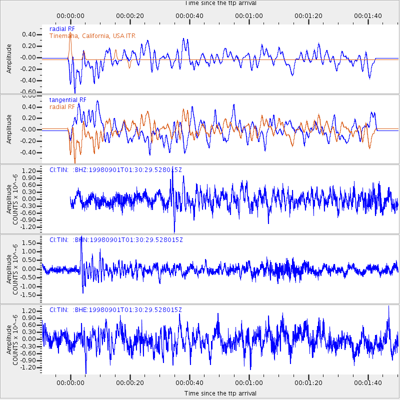
TIN Tinemaha, California, USA - Earthquake Result Viewer
*The percent match for this event was below the threshold and hence no stack was calculated.
| Earthquake location: |
Tonga Islands |
| Earthquake latitude/longitude: |
-17.6/-174.8 |
| Earthquake time(UTC): |
1998/09/01 (244) 01:19:37 GMT |
| Earthquake Depth: |
220 km |
| Earthquake Magnitude: |
5.6 UNKNOWN, 5.3 MB, 5.6 MW |
| Earthquake Catalog/Contributor: |
WHDF/NEIC |
|
| Network: |
CI Caltech Regional Seismic Network |
| Station: |
TIN Tinemaha, California, USA |
| Lat/Lon: |
37.05 N/118.23 W |
| Elevation: |
1164 m |
|
| Distance: |
76.1 deg |
| Az: |
43.447 deg |
| Baz: |
235.091 deg |
| Ray Param: |
$rayparam |
*The percent match for this event was below the threshold and hence was not used in the summary stack. |
|
| Radial Match: |
60.25935 % |
| Radial Bump: |
400 |
| Transverse Match: |
56.233425 % |
| Transverse Bump: |
400 |
| SOD ConfigId: |
4480 |
| Insert Time: |
2010-02-25 20:52:53.204 +0000 |
| GWidth: |
2.5 |
| Max Bumps: |
400 |
| Tol: |
0.001 |
|
Signal To Noise
| Channel | StoN | STA | LTA |
| CI:TIN: :BHN:19980901T01:30:29.528015Z | 3.5278242 | 5.656563E-7 | 1.6034141E-7 |
| CI:TIN: :BHE:19980901T01:30:29.528015Z | 1.2444375 | 2.9577527E-7 | 2.376779E-7 |
| CI:TIN: :BHZ:19980901T01:30:29.528015Z | 1.9959469 | 3.9576088E-7 | 1.9828227E-7 |
| Arrivals |
| Ps | |
| PpPs | |
| PsPs/PpSs | |


