You are here: Home > Network List > US - United States National Seismic Network Stations List
> Station AMTX Amarillo, Texas, USA > Earthquake Result Viewer
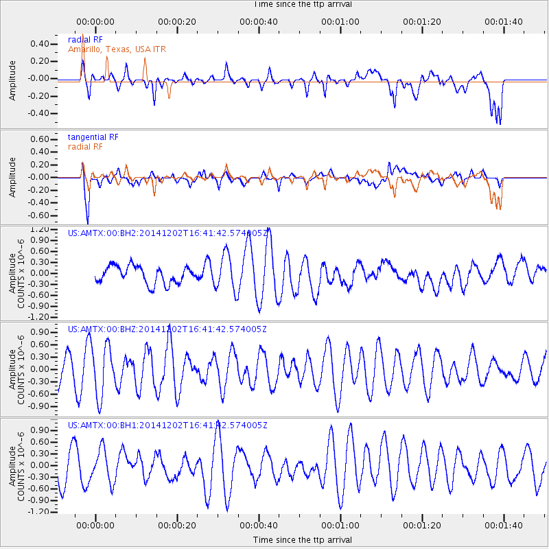
AMTX Amarillo, Texas, USA - Earthquake Result Viewer
*The percent match for this event was below the threshold and hence no stack was calculated.
| Earthquake location: |
Fox Islands, Aleutian Islands |
| Earthquake latitude/longitude: |
51.6/-171.2 |
| Earthquake time(UTC): |
2014/12/02 (336) 16:33:14 GMT |
| Earthquake Depth: |
53 km |
| Earthquake Magnitude: |
5.2 MW, 5.1 mb, 4.6 ML |
| Earthquake Catalog/Contributor: |
ISC/ISC |
|
| Network: |
US United States National Seismic Network |
| Station: |
AMTX Amarillo, Texas, USA |
| Lat/Lon: |
34.53 N/101.41 W |
| Elevation: |
1010 m |
|
| Distance: |
51.8 deg |
| Az: |
80.574 deg |
| Baz: |
311.87 deg |
| Ray Param: |
$rayparam |
*The percent match for this event was below the threshold and hence was not used in the summary stack. |
|
| Radial Match: |
40.930412 % |
| Radial Bump: |
400 |
| Transverse Match: |
58.879612 % |
| Transverse Bump: |
400 |
| SOD ConfigId: |
3390531 |
| Insert Time: |
2019-04-15 07:39:03.449 +0000 |
| GWidth: |
2.5 |
| Max Bumps: |
400 |
| Tol: |
0.001 |
|
Signal To Noise
| Channel | StoN | STA | LTA |
| US:AMTX:00:BHZ:20141202T16:41:42.574005Z | 2.5914721 | 6.0318786E-7 | 2.3275877E-7 |
| US:AMTX:00:BH1:20141202T16:41:42.574005Z | 1.0495888 | 4.2962694E-7 | 4.0932878E-7 |
| US:AMTX:00:BH2:20141202T16:41:42.574005Z | 2.5942864 | 6.490396E-7 | 2.501804E-7 |
| Arrivals |
| Ps | |
| PpPs | |
| PsPs/PpSs | |


