You are here: Home > Network List > IU - Global Seismograph Network (GSN - IRIS/USGS) Stations List
> Station HNR Honiara, Solomon Islands > Earthquake Result Viewer
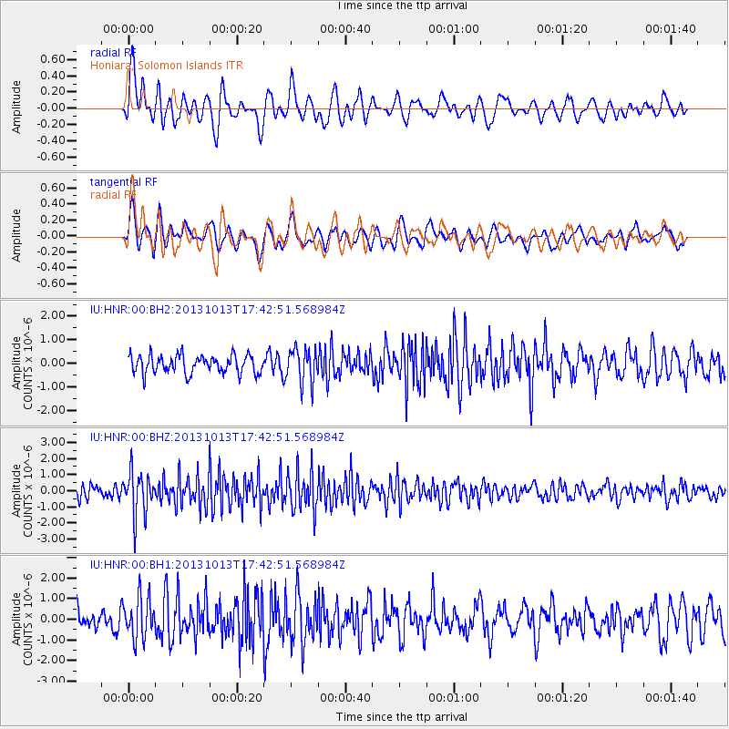
HNR Honiara, Solomon Islands - Earthquake Result Viewer
*The percent match for this event was below the threshold and hence no stack was calculated.
| Earthquake location: |
Off W Coast Of Northern Sumatra |
| Earthquake latitude/longitude: |
4.0/95.9 |
| Earthquake time(UTC): |
2013/10/13 (286) 17:32:45 GMT |
| Earthquake Depth: |
46 km |
| Earthquake Magnitude: |
5.6 MWB, 5.6 MWC |
| Earthquake Catalog/Contributor: |
NEIC PDE/NEIC COMCAT |
|
| Network: |
IU Global Seismograph Network (GSN - IRIS/USGS) |
| Station: |
HNR Honiara, Solomon Islands |
| Lat/Lon: |
9.44 S/159.95 E |
| Elevation: |
100 m |
|
| Distance: |
65.2 deg |
| Az: |
102.217 deg |
| Baz: |
278.792 deg |
| Ray Param: |
$rayparam |
*The percent match for this event was below the threshold and hence was not used in the summary stack. |
|
| Radial Match: |
66.36766 % |
| Radial Bump: |
400 |
| Transverse Match: |
66.619026 % |
| Transverse Bump: |
400 |
| SOD ConfigId: |
626651 |
| Insert Time: |
2014-04-19 03:10:37.543 +0000 |
| GWidth: |
2.5 |
| Max Bumps: |
400 |
| Tol: |
0.001 |
|
Signal To Noise
| Channel | StoN | STA | LTA |
| IU:HNR:00:BHZ:20131013T17:42:51.568984Z | 3.8696198 | 1.3716269E-6 | 3.5446038E-7 |
| IU:HNR:00:BH1:20131013T17:42:51.568984Z | 1.6720449 | 9.937802E-7 | 5.943502E-7 |
| IU:HNR:00:BH2:20131013T17:42:51.568984Z | 1.9444584 | 7.4043277E-7 | 3.8079125E-7 |
| Arrivals |
| Ps | |
| PpPs | |
| PsPs/PpSs | |


