You are here: Home > Network List > TA - USArray Transportable Network (new EarthScope stations) Stations List
> Station G59A Clarenceville, QC, USA > Earthquake Result Viewer
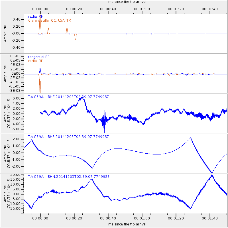
G59A Clarenceville, QC, USA - Earthquake Result Viewer
*The percent match for this event was below the threshold and hence no stack was calculated.
| Earthquake location: |
Near Coast Of Northern Chile |
| Earthquake latitude/longitude: |
-19.8/-70.7 |
| Earthquake time(UTC): |
2014/12/03 (337) 02:29:03 GMT |
| Earthquake Depth: |
29 km |
| Earthquake Magnitude: |
4.9 MW, 4.3 mb, 4.4 mb1, 4.3 mb1mx, 4.4 mbtmp, 4.0 ML, 4.1 MS, 4.1 Ms1, 3.8 ms1mx |
| Earthquake Catalog/Contributor: |
ISC/ISC |
|
| Network: |
TA USArray Transportable Network (new EarthScope stations) |
| Station: |
G59A Clarenceville, QC, USA |
| Lat/Lon: |
45.08 N/73.18 W |
| Elevation: |
36 m |
|
| Distance: |
64.6 deg |
| Az: |
358.071 deg |
| Baz: |
177.436 deg |
| Ray Param: |
$rayparam |
*The percent match for this event was below the threshold and hence was not used in the summary stack. |
|
| Radial Match: |
98.89102 % |
| Radial Bump: |
83 |
| Transverse Match: |
82.96585 % |
| Transverse Bump: |
250 |
| SOD ConfigId: |
3390531 |
| Insert Time: |
2019-04-15 07:51:43.877 +0000 |
| GWidth: |
2.5 |
| Max Bumps: |
400 |
| Tol: |
0.001 |
|
Signal To Noise
| Channel | StoN | STA | LTA |
| TA:G59A: :BHZ:20141203T02:39:07.774998Z | 1.4744766 | 0.0010968191 | 7.438701E-4 |
| TA:G59A: :BHN:20141203T02:39:07.774998Z | 1.6263273 | 6.297464E-6 | 3.8721996E-6 |
| TA:G59A: :BHE:20141203T02:39:07.774998Z | 1.6870244 | 3.1174518E-6 | 1.8478997E-6 |
| Arrivals |
| Ps | |
| PpPs | |
| PsPs/PpSs | |


