You are here: Home > Network List > IU - Global Seismograph Network (GSN - IRIS/USGS) Stations List
> Station POHA Pohakuloa, Hawaii, USA > Earthquake Result Viewer
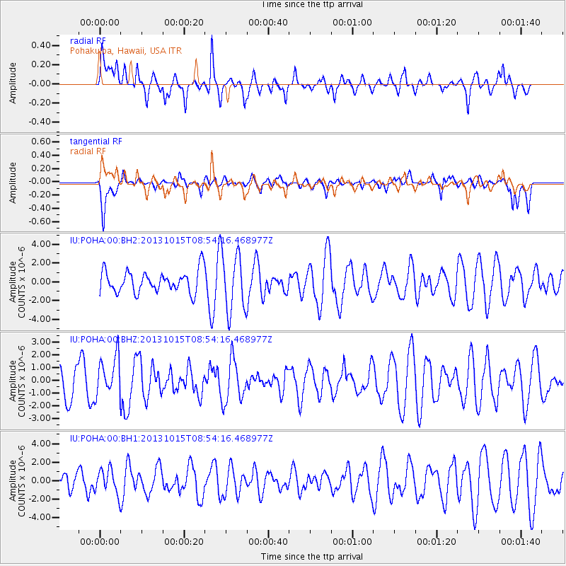
POHA Pohakuloa, Hawaii, USA - Earthquake Result Viewer
*The percent match for this event was below the threshold and hence no stack was calculated.
| Earthquake location: |
Negros, Philippines |
| Earthquake latitude/longitude: |
9.8/123.7 |
| Earthquake time(UTC): |
2013/10/15 (288) 08:42:49 GMT |
| Earthquake Depth: |
16 km |
| Earthquake Magnitude: |
5.7 MWW, 5.5 MWB, 5.7 MWW, 5.7 MWC |
| Earthquake Catalog/Contributor: |
NEIC PDE/NEIC COMCAT |
|
| Network: |
IU Global Seismograph Network (GSN - IRIS/USGS) |
| Station: |
POHA Pohakuloa, Hawaii, USA |
| Lat/Lon: |
19.76 N/155.53 W |
| Elevation: |
1990 m |
|
| Distance: |
78.1 deg |
| Az: |
71.798 deg |
| Baz: |
276.223 deg |
| Ray Param: |
$rayparam |
*The percent match for this event was below the threshold and hence was not used in the summary stack. |
|
| Radial Match: |
44.583664 % |
| Radial Bump: |
400 |
| Transverse Match: |
59.092228 % |
| Transverse Bump: |
400 |
| SOD ConfigId: |
626651 |
| Insert Time: |
2014-04-19 03:44:25.470 +0000 |
| GWidth: |
2.5 |
| Max Bumps: |
400 |
| Tol: |
0.001 |
|
Signal To Noise
| Channel | StoN | STA | LTA |
| IU:POHA:00:BHZ:20131015T08:54:16.468977Z | 1.0444735 | 1.5587419E-6 | 1.492371E-6 |
| IU:POHA:00:BH1:20131015T08:54:16.468977Z | 0.54594505 | 1.3586566E-6 | 2.4886326E-6 |
| IU:POHA:00:BH2:20131015T08:54:16.468977Z | 2.600822 | 2.9899181E-6 | 1.149605E-6 |
| Arrivals |
| Ps | |
| PpPs | |
| PsPs/PpSs | |


