You are here: Home > Network List > AV - Alaska Volcano Observatory Stations List
> Station MAPS Pakushin Southeast, Makushin Volcano, Alaska > Earthquake Result Viewer
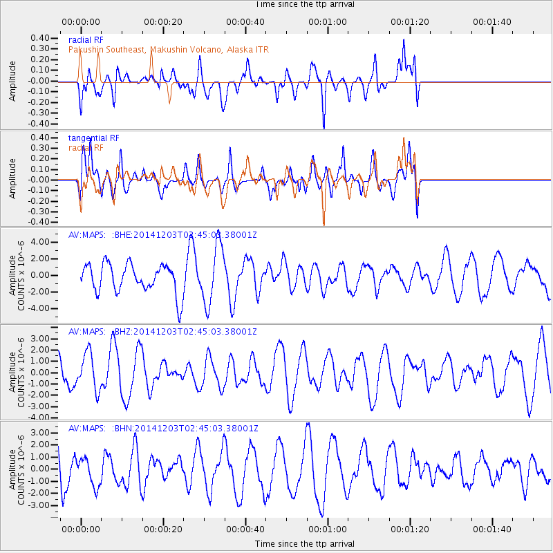
MAPS Pakushin Southeast, Makushin Volcano, Alaska - Earthquake Result Viewer
*The percent match for this event was below the threshold and hence no stack was calculated.
| Earthquake location: |
Sulawesi, Indonesia |
| Earthquake latitude/longitude: |
-2.9/122.4 |
| Earthquake time(UTC): |
2014/12/03 (337) 02:33:24 GMT |
| Earthquake Depth: |
48 km |
| Earthquake Magnitude: |
5.0 MW, 4.8 mb |
| Earthquake Catalog/Contributor: |
ISC/ISC |
|
| Network: |
AV Alaska Volcano Observatory |
| Station: |
MAPS Pakushin Southeast, Makushin Volcano, Alaska |
| Lat/Lon: |
53.81 N/166.94 W |
| Elevation: |
333 m |
|
| Distance: |
81.0 deg |
| Az: |
34.504 deg |
| Baz: |
252.546 deg |
| Ray Param: |
$rayparam |
*The percent match for this event was below the threshold and hence was not used in the summary stack. |
|
| Radial Match: |
58.089333 % |
| Radial Bump: |
400 |
| Transverse Match: |
48.251434 % |
| Transverse Bump: |
355 |
| SOD ConfigId: |
3390531 |
| Insert Time: |
2019-04-15 07:56:49.224 +0000 |
| GWidth: |
2.5 |
| Max Bumps: |
400 |
| Tol: |
0.001 |
|
Signal To Noise
| Channel | StoN | STA | LTA |
| AV:MAPS: :BHZ:20141203T02:45:03.38001Z | 1.6830693 | 1.646687E-6 | 9.783834E-7 |
| AV:MAPS: :BHN:20141203T02:45:03.38001Z | 0.7983616 | 1.1953969E-6 | 1.4973126E-6 |
| AV:MAPS: :BHE:20141203T02:45:03.38001Z | 2.0678303 | 3.5548871E-6 | 1.7191386E-6 |
| Arrivals |
| Ps | |
| PpPs | |
| PsPs/PpSs | |


