You are here: Home > Network List > TA - USArray Transportable Network (new EarthScope stations) Stations List
> Station K61A Williamstown, MA, USA > Earthquake Result Viewer
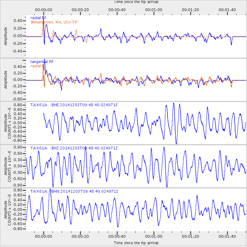
K61A Williamstown, MA, USA - Earthquake Result Viewer
*The percent match for this event was below the threshold and hence no stack was calculated.
| Earthquake location: |
Near Coast Of Northern Chile |
| Earthquake latitude/longitude: |
-22.6/-70.3 |
| Earthquake time(UTC): |
2014/12/03 (337) 09:38:36 GMT |
| Earthquake Depth: |
56 km |
| Earthquake Magnitude: |
5.1 MW, 5.4 mb, 5.1 Mwr, 5.2 Mww, 5.2 ML |
| Earthquake Catalog/Contributor: |
ISC/ISC |
|
| Network: |
TA USArray Transportable Network (new EarthScope stations) |
| Station: |
K61A Williamstown, MA, USA |
| Lat/Lon: |
42.67 N/73.27 W |
| Elevation: |
391 m |
|
| Distance: |
65.0 deg |
| Az: |
357.59 deg |
| Baz: |
176.98 deg |
| Ray Param: |
$rayparam |
*The percent match for this event was below the threshold and hence was not used in the summary stack. |
|
| Radial Match: |
54.06498 % |
| Radial Bump: |
400 |
| Transverse Match: |
64.36145 % |
| Transverse Bump: |
400 |
| SOD ConfigId: |
3390531 |
| Insert Time: |
2019-04-15 08:05:52.150 +0000 |
| GWidth: |
2.5 |
| Max Bumps: |
400 |
| Tol: |
0.001 |
|
Signal To Noise
| Channel | StoN | STA | LTA |
| TA:K61A: :BHZ:20141203T09:48:40.024971Z | 0.973369 | 2.8596094E-7 | 2.937847E-7 |
| TA:K61A: :BHN:20141203T09:48:40.024971Z | 1.7950442 | 5.0536903E-7 | 2.815357E-7 |
| TA:K61A: :BHE:20141203T09:48:40.024971Z | 0.68990403 | 1.9324094E-7 | 2.800983E-7 |
| Arrivals |
| Ps | |
| PpPs | |
| PsPs/PpSs | |


