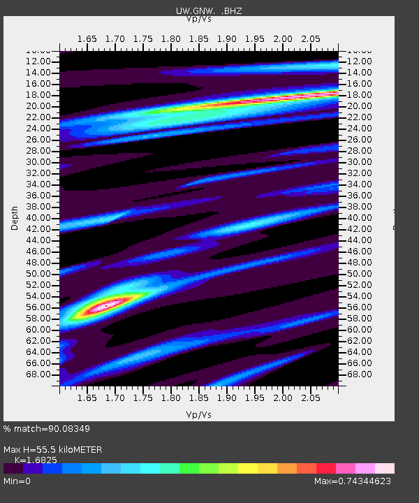
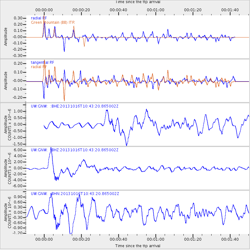
GNW Green Mountain (BB) - Earthquake Result Viewer

Earthquake location: Solomon Islands
Earthquake latitude/longitude: -6.4/154.9
Earthquake time(UTC): 2013/10/16 (289) 10:30:58 GMT
Earthquake Depth: 35 km
Earthquake Magnitude: 6.8 MWW, 6.7 MWB, 6.8 MWW, 6.8 MWC, 7.1 MI
Earthquake Catalog/Contributor: NEIC PDE/NEIC COMCAT
Network: UW Pacific Northwest Regional Seismic Network
Station: GNW Green Mountain (BB)
Lat/Lon: 47.56 N/122.83 W
Elevation: 160 m
Distance: 89.5 deg
Az: 42.149 deg
Baz: 259.967 deg
Ray Param: 0.04176252
Estimated Moho Depth: 55.5 km
Estimated Crust Vp/Vs: 1.68
Assumed Crust Vp: 6.566 km/s
Estimated Crust Vs: 3.903 km/s
Estimated Crust Poisson's Ratio: 0.23
Radial Match: 90.08349 %
Radial Bump: 383
Transverse Match: 86.279045 %
Transverse Bump: 400
SOD ConfigId: 626651
Insert Time: 2014-04-19 04:10:44.707 +0000
GWidth: 2.5
Max Bumps: 400
Tol: 0.001

Signal To Noise

ChannelStoNSTALTA
UW:GNW: :BHZ:20131016T10:43:20.865002Z28.4404323.1394663E-61.1038744E-7
UW:GNW: :BHN:20131016T10:43:20.865002Z3.72818165.265045E-71.4122286E-7
UW:GNW: :BHE:20131016T10:43:20.865002Z4.0631645.670507E-71.3955889E-7
Arrivals
Ps5.9 SECOND
PpPs22 SECOND
PsPs/PpSs28 SECOND