
LTY Liberty (broad-band) - Earthquake Result Viewer
| ||||||||||||||||||
| ||||||||||||||||||
| ||||||||||||||||||
|
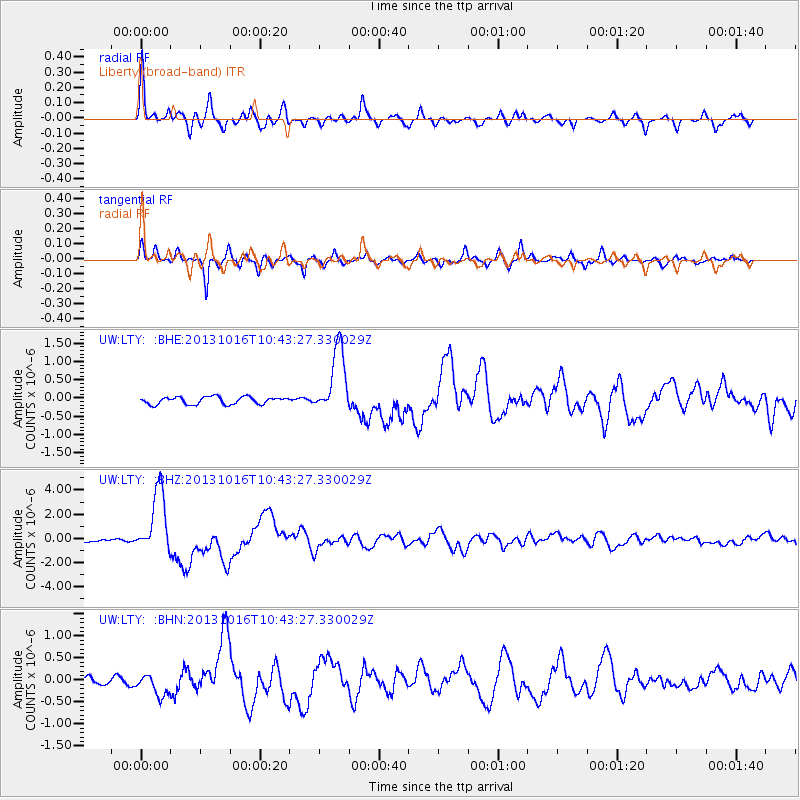
Signal To Noise
| Channel | StoN | STA | LTA |
| UW:LTY: :BHZ:20131016T10:43:27.330029Z | 27.929876 | 2.6409382E-6 | 9.455603E-8 |
| UW:LTY: :BHN:20131016T10:43:27.330029Z | 3.276833 | 2.5304033E-7 | 7.7220996E-8 |
| UW:LTY: :BHE:20131016T10:43:27.330029Z | 9.077641 | 9.127591E-7 | 1.0055025E-7 |
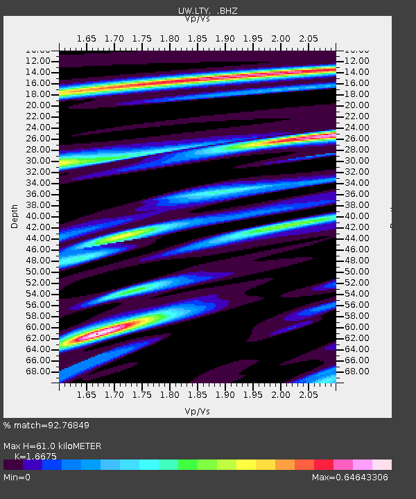
| Arrivals | |
| Ps | 6.3 SECOND |
| PpPs | 24 SECOND |
| PsPs/PpSs | 30 SECOND |

