You are here: Home > Network List > UW - Pacific Northwest Regional Seismic Network Stations List
> Station PASS Maple Falls, WA, USA > Earthquake Result Viewer
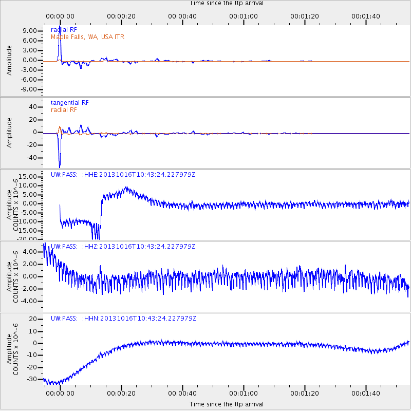
PASS Maple Falls, WA, USA - Earthquake Result Viewer
*The percent match for this event was below the threshold and hence no stack was calculated.
| Earthquake location: |
Solomon Islands |
| Earthquake latitude/longitude: |
-6.4/154.9 |
| Earthquake time(UTC): |
2013/10/16 (289) 10:30:58 GMT |
| Earthquake Depth: |
35 km |
| Earthquake Magnitude: |
6.8 MWW, 6.7 MWB, 6.8 MWW, 6.8 MWC, 7.1 MI |
| Earthquake Catalog/Contributor: |
NEIC PDE/NEIC COMCAT |
|
| Network: |
UW Pacific Northwest Regional Seismic Network |
| Station: |
PASS Maple Falls, WA, USA |
| Lat/Lon: |
49.00 N/122.09 W |
| Elevation: |
174 m |
|
| Distance: |
90.2 deg |
| Az: |
40.818 deg |
| Baz: |
260.515 deg |
| Ray Param: |
$rayparam |
*The percent match for this event was below the threshold and hence was not used in the summary stack. |
|
| Radial Match: |
69.23069 % |
| Radial Bump: |
215 |
| Transverse Match: |
62.525562 % |
| Transverse Bump: |
243 |
| SOD ConfigId: |
626651 |
| Insert Time: |
2014-04-19 04:11:15.347 +0000 |
| GWidth: |
2.5 |
| Max Bumps: |
400 |
| Tol: |
0.001 |
|
Signal To Noise
| Channel | StoN | STA | LTA |
| UW:PASS: :HHZ:20131016T10:43:24.227979Z | 0.53200805 | 4.025539E-6 | 7.566688E-6 |
| UW:PASS: :HHN:20131016T10:43:24.227979Z | 0.046513774 | 1.4151831E-5 | 3.0425034E-4 |
| UW:PASS: :HHE:20131016T10:43:24.227979Z | 0.53139627 | 4.6689884E-6 | 8.786265E-6 |
| Arrivals |
| Ps | |
| PpPs | |
| PsPs/PpSs | |


