You are here: Home > Network List > IU - Global Seismograph Network (GSN - IRIS/USGS) Stations List
> Station PMG Port Moresby, New Guinea > Earthquake Result Viewer
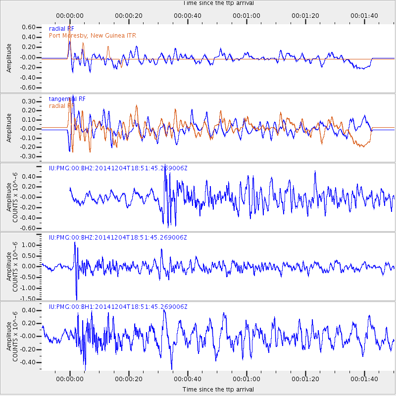
PMG Port Moresby, New Guinea - Earthquake Result Viewer
*The percent match for this event was below the threshold and hence no stack was calculated.
| Earthquake location: |
South Of Fiji Islands |
| Earthquake latitude/longitude: |
-24.6/-177.1 |
| Earthquake time(UTC): |
2014/12/04 (338) 18:45:14 GMT |
| Earthquake Depth: |
110 km |
| Earthquake Magnitude: |
5.4 MW, 5.4 mb |
| Earthquake Catalog/Contributor: |
ISC/ISC |
|
| Network: |
IU Global Seismograph Network (GSN - IRIS/USGS) |
| Station: |
PMG Port Moresby, New Guinea |
| Lat/Lon: |
9.40 S/147.16 E |
| Elevation: |
90 m |
|
| Distance: |
37.2 deg |
| Az: |
287.663 deg |
| Baz: |
118.472 deg |
| Ray Param: |
$rayparam |
*The percent match for this event was below the threshold and hence was not used in the summary stack. |
|
| Radial Match: |
58.714725 % |
| Radial Bump: |
400 |
| Transverse Match: |
65.790306 % |
| Transverse Bump: |
400 |
| SOD ConfigId: |
3390531 |
| Insert Time: |
2019-04-15 08:16:52.010 +0000 |
| GWidth: |
2.5 |
| Max Bumps: |
400 |
| Tol: |
0.001 |
|
Signal To Noise
| Channel | StoN | STA | LTA |
| IU:PMG:00:BHZ:20141204T18:51:45.269006Z | 3.6319675 | 4.783577E-7 | 1.317076E-7 |
| IU:PMG:00:BH1:20141204T18:51:45.269006Z | 1.3269495 | 1.3822678E-7 | 1.0416884E-7 |
| IU:PMG:00:BH2:20141204T18:51:45.269006Z | 3.5191128 | 2.8888857E-7 | 8.2091304E-8 |
| Arrivals |
| Ps | |
| PpPs | |
| PsPs/PpSs | |


