You are here: Home > Network List > TA - USArray Transportable Network (new EarthScope stations) Stations List
> Station G05D Wamic, OR, USA > Earthquake Result Viewer
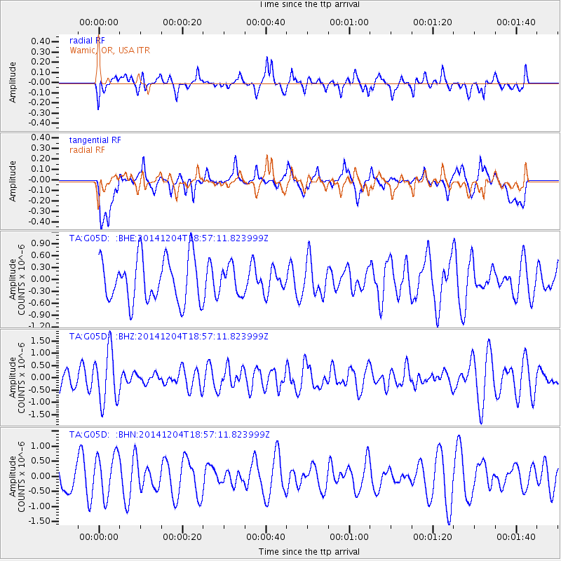
G05D Wamic, OR, USA - Earthquake Result Viewer
*The percent match for this event was below the threshold and hence no stack was calculated.
| Earthquake location: |
South Of Fiji Islands |
| Earthquake latitude/longitude: |
-24.6/-177.1 |
| Earthquake time(UTC): |
2014/12/04 (338) 18:45:14 GMT |
| Earthquake Depth: |
110 km |
| Earthquake Magnitude: |
5.4 MW, 5.4 mb |
| Earthquake Catalog/Contributor: |
ISC/ISC |
|
| Network: |
TA USArray Transportable Network (new EarthScope stations) |
| Station: |
G05D Wamic, OR, USA |
| Lat/Lon: |
45.24 N/121.32 W |
| Elevation: |
592 m |
|
| Distance: |
86.0 deg |
| Az: |
35.833 deg |
| Baz: |
228.965 deg |
| Ray Param: |
$rayparam |
*The percent match for this event was below the threshold and hence was not used in the summary stack. |
|
| Radial Match: |
37.48965 % |
| Radial Bump: |
400 |
| Transverse Match: |
32.347023 % |
| Transverse Bump: |
400 |
| SOD ConfigId: |
3390531 |
| Insert Time: |
2019-04-15 08:18:18.125 +0000 |
| GWidth: |
2.5 |
| Max Bumps: |
400 |
| Tol: |
0.001 |
|
Signal To Noise
| Channel | StoN | STA | LTA |
| TA:G05D: :BHZ:20141204T18:57:11.823999Z | 2.7238615 | 1.0789191E-6 | 3.9609915E-7 |
| TA:G05D: :BHN:20141204T18:57:11.823999Z | 1.6072737 | 7.286865E-7 | 4.53368E-7 |
| TA:G05D: :BHE:20141204T18:57:11.823999Z | 0.6268663 | 3.5099868E-7 | 5.599259E-7 |
| Arrivals |
| Ps | |
| PpPs | |
| PsPs/PpSs | |


