You are here: Home > Network List > GT - Global Telemetered Seismograph Network (USAF/USGS) Stations List
> Station LPAZ La Paz , Bolivia > Earthquake Result Viewer
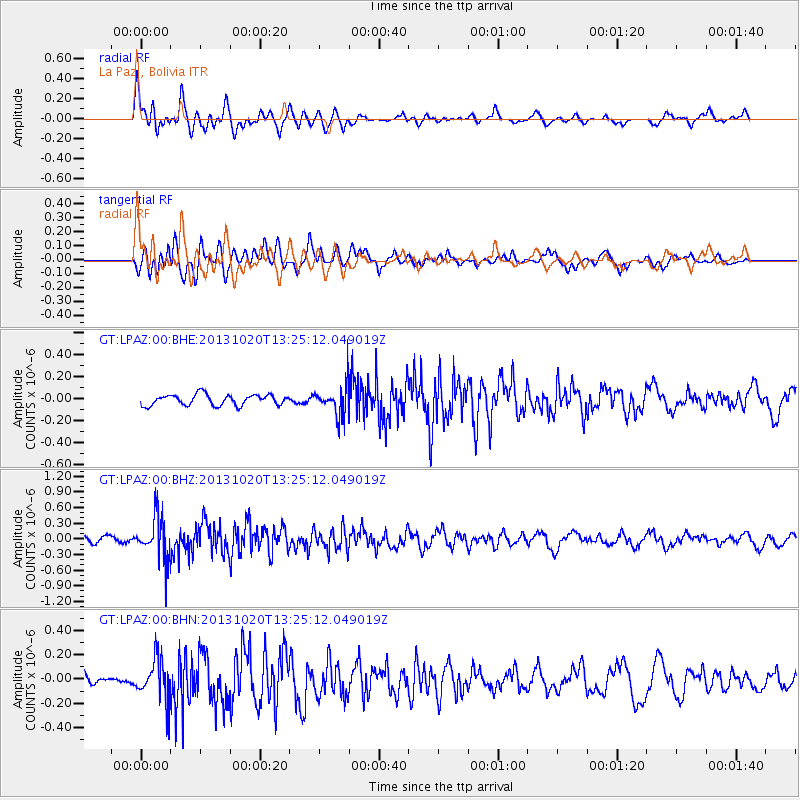
LPAZ La Paz , Bolivia - Earthquake Result Viewer
*The percent match for this event was below the threshold and hence no stack was calculated.
| Earthquake location: |
South Sandwich Islands Region |
| Earthquake latitude/longitude: |
-56.5/-25.7 |
| Earthquake time(UTC): |
2013/10/20 (293) 13:16:38 GMT |
| Earthquake Depth: |
10 km |
| Earthquake Magnitude: |
5.6 MWC, 5.6 MWC |
| Earthquake Catalog/Contributor: |
NEIC PDE/NEIC COMCAT |
|
| Network: |
GT Global Telemetered Seismograph Network (USAF/USGS) |
| Station: |
LPAZ La Paz , Bolivia |
| Lat/Lon: |
16.17 S/68.08 W |
| Elevation: |
4817 m |
|
| Distance: |
51.4 deg |
| Az: |
304.021 deg |
| Baz: |
151.436 deg |
| Ray Param: |
$rayparam |
*The percent match for this event was below the threshold and hence was not used in the summary stack. |
|
| Radial Match: |
65.18455 % |
| Radial Bump: |
400 |
| Transverse Match: |
66.92739 % |
| Transverse Bump: |
400 |
| SOD ConfigId: |
626651 |
| Insert Time: |
2014-04-19 04:29:09.322 +0000 |
| GWidth: |
2.5 |
| Max Bumps: |
400 |
| Tol: |
0.001 |
|
Signal To Noise
| Channel | StoN | STA | LTA |
| GT:LPAZ:00:BHZ:20131020T13:25:12.049019Z | 6.4274263 | 4.0839967E-7 | 6.3540156E-8 |
| GT:LPAZ:00:BHN:20131020T13:25:12.049019Z | 1.874937 | 1.6998241E-7 | 9.0660336E-8 |
| GT:LPAZ:00:BHE:20131020T13:25:12.049019Z | 3.151221 | 1.5100565E-7 | 4.7919723E-8 |
| Arrivals |
| Ps | |
| PpPs | |
| PsPs/PpSs | |


