You are here: Home > Network List > IU - Global Seismograph Network (GSN - IRIS/USGS) Stations List
> Station PMG Port Moresby, New Guinea > Earthquake Result Viewer
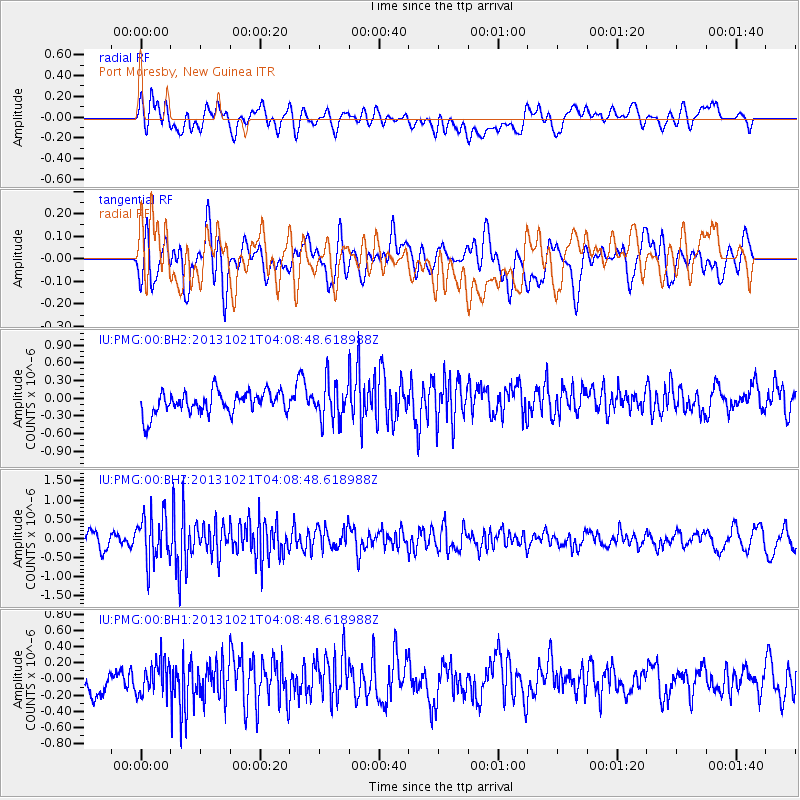
PMG Port Moresby, New Guinea - Earthquake Result Viewer
*The percent match for this event was below the threshold and hence no stack was calculated.
| Earthquake location: |
Tonga Islands Region |
| Earthquake latitude/longitude: |
-22.9/-174.7 |
| Earthquake time(UTC): |
2013/10/21 (294) 04:01:54 GMT |
| Earthquake Depth: |
12 km |
| Earthquake Magnitude: |
5.5 MWB, 5.6 MWC |
| Earthquake Catalog/Contributor: |
NEIC PDE/NEIC COMCAT |
|
| Network: |
IU Global Seismograph Network (GSN - IRIS/USGS) |
| Station: |
PMG Port Moresby, New Guinea |
| Lat/Lon: |
9.40 S/147.16 E |
| Elevation: |
90 m |
|
| Distance: |
38.9 deg |
| Az: |
283.941 deg |
| Baz: |
114.949 deg |
| Ray Param: |
$rayparam |
*The percent match for this event was below the threshold and hence was not used in the summary stack. |
|
| Radial Match: |
61.44534 % |
| Radial Bump: |
400 |
| Transverse Match: |
55.49159 % |
| Transverse Bump: |
400 |
| SOD ConfigId: |
626651 |
| Insert Time: |
2014-04-19 04:39:15.366 +0000 |
| GWidth: |
2.5 |
| Max Bumps: |
400 |
| Tol: |
0.001 |
|
Signal To Noise
| Channel | StoN | STA | LTA |
| IU:PMG:00:BHZ:20131021T04:08:48.618988Z | 3.7388754 | 6.138227E-7 | 1.6417307E-7 |
| IU:PMG:00:BH1:20131021T04:08:48.618988Z | 1.5057935 | 2.0019205E-7 | 1.3294787E-7 |
| IU:PMG:00:BH2:20131021T04:08:48.618988Z | 1.6847838 | 3.1635804E-7 | 1.8777368E-7 |
| Arrivals |
| Ps | |
| PpPs | |
| PsPs/PpSs | |


