You are here: Home > Network List > TA - USArray Transportable Network (new EarthScope stations) Stations List
> Station W39A Magazine, AR, USA > Earthquake Result Viewer
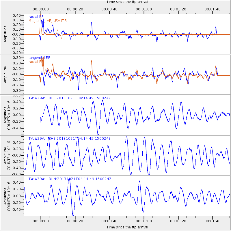
W39A Magazine, AR, USA - Earthquake Result Viewer
*The percent match for this event was below the threshold and hence no stack was calculated.
| Earthquake location: |
Tonga Islands Region |
| Earthquake latitude/longitude: |
-22.9/-174.7 |
| Earthquake time(UTC): |
2013/10/21 (294) 04:01:54 GMT |
| Earthquake Depth: |
12 km |
| Earthquake Magnitude: |
5.5 MWB, 5.6 MWC |
| Earthquake Catalog/Contributor: |
NEIC PDE/NEIC COMCAT |
|
| Network: |
TA USArray Transportable Network (new EarthScope stations) |
| Station: |
W39A Magazine, AR, USA |
| Lat/Lon: |
35.20 N/93.78 W |
| Elevation: |
162 m |
|
| Distance: |
95.9 deg |
| Az: |
54.401 deg |
| Baz: |
246.232 deg |
| Ray Param: |
$rayparam |
*The percent match for this event was below the threshold and hence was not used in the summary stack. |
|
| Radial Match: |
67.78926 % |
| Radial Bump: |
400 |
| Transverse Match: |
49.49886 % |
| Transverse Bump: |
400 |
| SOD ConfigId: |
626651 |
| Insert Time: |
2014-04-19 04:43:06.187 +0000 |
| GWidth: |
2.5 |
| Max Bumps: |
400 |
| Tol: |
0.001 |
|
Signal To Noise
| Channel | StoN | STA | LTA |
| TA:W39A: :BHZ:20131021T04:14:49.150024Z | 0.79994214 | 2.9433335E-7 | 3.679433E-7 |
| TA:W39A: :BHN:20131021T04:14:49.150024Z | 0.5491542 | 9.658006E-8 | 1.7587055E-7 |
| TA:W39A: :BHE:20131021T04:14:49.150024Z | 1.8849628 | 3.4723783E-7 | 1.8421468E-7 |
| Arrivals |
| Ps | |
| PpPs | |
| PsPs/PpSs | |


