You are here: Home > Network List > AZ - ANZA Regional Network Stations List
> Station SMER AZ.SMER > Earthquake Result Viewer
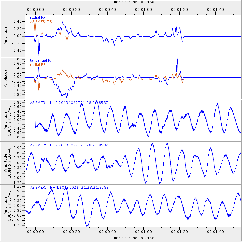
SMER AZ.SMER - Earthquake Result Viewer
*The percent match for this event was below the threshold and hence no stack was calculated.
| Earthquake location: |
Solomon Islands |
| Earthquake latitude/longitude: |
-6.3/155.0 |
| Earthquake time(UTC): |
2013/10/22 (295) 21:15:51 GMT |
| Earthquake Depth: |
50 km |
| Earthquake Magnitude: |
5.5 MWW, 5.4 MWW, 5.5 MWB, 5.5 MWC |
| Earthquake Catalog/Contributor: |
NEIC PDE/NEIC COMCAT |
|
| Network: |
AZ ANZA Regional Network |
| Station: |
SMER AZ.SMER |
| Lat/Lon: |
33.46 N/117.17 W |
| Elevation: |
355 m |
|
| Distance: |
91.7 deg |
| Az: |
56.696 deg |
| Baz: |
263.56 deg |
| Ray Param: |
$rayparam |
*The percent match for this event was below the threshold and hence was not used in the summary stack. |
|
| Radial Match: |
79.13145 % |
| Radial Bump: |
400 |
| Transverse Match: |
61.2009 % |
| Transverse Bump: |
400 |
| SOD ConfigId: |
626651 |
| Insert Time: |
2014-04-19 04:48:33.549 +0000 |
| GWidth: |
2.5 |
| Max Bumps: |
400 |
| Tol: |
0.001 |
|
Signal To Noise
| Channel | StoN | STA | LTA |
| AZ:SMER: :HHZ:20131022T21:28:21.858Z | 0.9810269 | 3.374378E-7 | 3.4396388E-7 |
| AZ:SMER: :HHN:20131022T21:28:21.858Z | 0.9920468 | 4.5822793E-7 | 4.6190152E-7 |
| AZ:SMER: :HHE:20131022T21:28:21.858Z | 2.171436 | 6.375581E-7 | 2.9361127E-7 |
| Arrivals |
| Ps | |
| PpPs | |
| PsPs/PpSs | |


