You are here: Home > Network List > UW - Pacific Northwest Regional Seismic Network Stations List
> Station UMAT Pilot Rock, OR, USA > Earthquake Result Viewer
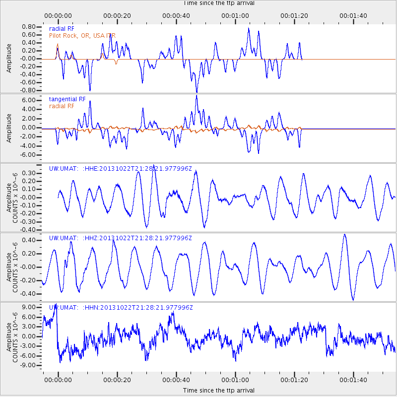
UMAT Pilot Rock, OR, USA - Earthquake Result Viewer
*The percent match for this event was below the threshold and hence no stack was calculated.
| Earthquake location: |
Solomon Islands |
| Earthquake latitude/longitude: |
-6.3/155.0 |
| Earthquake time(UTC): |
2013/10/22 (295) 21:15:51 GMT |
| Earthquake Depth: |
50 km |
| Earthquake Magnitude: |
5.5 MWW, 5.4 MWW, 5.5 MWB, 5.5 MWC |
| Earthquake Catalog/Contributor: |
NEIC PDE/NEIC COMCAT |
|
| Network: |
UW Pacific Northwest Regional Seismic Network |
| Station: |
UMAT Pilot Rock, OR, USA |
| Lat/Lon: |
45.29 N/118.96 W |
| Elevation: |
1318 m |
|
| Distance: |
91.7 deg |
| Az: |
44.793 deg |
| Baz: |
262.776 deg |
| Ray Param: |
$rayparam |
*The percent match for this event was below the threshold and hence was not used in the summary stack. |
|
| Radial Match: |
35.68108 % |
| Radial Bump: |
400 |
| Transverse Match: |
28.578796 % |
| Transverse Bump: |
400 |
| SOD ConfigId: |
626651 |
| Insert Time: |
2014-04-19 04:57:47.167 +0000 |
| GWidth: |
2.5 |
| Max Bumps: |
400 |
| Tol: |
0.001 |
|
Signal To Noise
| Channel | StoN | STA | LTA |
| UW:UMAT: :HHZ:20131022T21:28:21.977996Z | 1.7190242 | 2.4301002E-7 | 1.4136509E-7 |
| UW:UMAT: :HHN:20131022T21:28:21.977996Z | 2.4398363 | 5.809491E-6 | 2.3810987E-6 |
| UW:UMAT: :HHE:20131022T21:28:21.977996Z | 2.0920904 | 2.4917074E-7 | 1.1910133E-7 |
| Arrivals |
| Ps | |
| PpPs | |
| PsPs/PpSs | |


