You are here: Home > Network List > AV - Alaska Volcano Observatory Stations List
> Station SPCR Ckakachatna River, Mount Spurr, Alaska > Earthquake Result Viewer
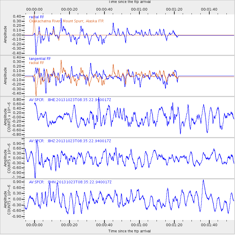
SPCR Ckakachatna River, Mount Spurr, Alaska - Earthquake Result Viewer
*The percent match for this event was below the threshold and hence no stack was calculated.
| Earthquake location: |
South Of Fiji Islands |
| Earthquake latitude/longitude: |
-23.0/-177.1 |
| Earthquake time(UTC): |
2013/10/23 (296) 08:23:30 GMT |
| Earthquake Depth: |
160 km |
| Earthquake Magnitude: |
6.0 MWB, 6.0 MWC |
| Earthquake Catalog/Contributor: |
NEIC PDE/NEIC COMCAT |
|
| Network: |
AV Alaska Volcano Observatory |
| Station: |
SPCR Ckakachatna River, Mount Spurr, Alaska |
| Lat/Lon: |
61.20 N/152.21 W |
| Elevation: |
984 m |
|
| Distance: |
86.3 deg |
| Az: |
11.804 deg |
| Baz: |
202.907 deg |
| Ray Param: |
$rayparam |
*The percent match for this event was below the threshold and hence was not used in the summary stack. |
|
| Radial Match: |
49.852825 % |
| Radial Bump: |
301 |
| Transverse Match: |
56.086617 % |
| Transverse Bump: |
400 |
| SOD ConfigId: |
626651 |
| Insert Time: |
2014-04-19 05:03:53.008 +0000 |
| GWidth: |
2.5 |
| Max Bumps: |
400 |
| Tol: |
0.001 |
|
Signal To Noise
| Channel | StoN | STA | LTA |
| AV:SPCR: :BHZ:20131023T08:35:22.940017Z | 2.2630246 | 5.89169E-7 | 2.6034584E-7 |
| AV:SPCR: :BHN:20131023T08:35:22.940017Z | 0.7960745 | 2.4103593E-7 | 3.0278062E-7 |
| AV:SPCR: :BHE:20131023T08:35:22.940017Z | 1.0736294 | 2.6385337E-7 | 2.4575832E-7 |
| Arrivals |
| Ps | |
| PpPs | |
| PsPs/PpSs | |


