You are here: Home > Network List > TA - USArray Transportable Network (new EarthScope stations) Stations List
> Station G59A Clarenceville, QC, USA > Earthquake Result Viewer
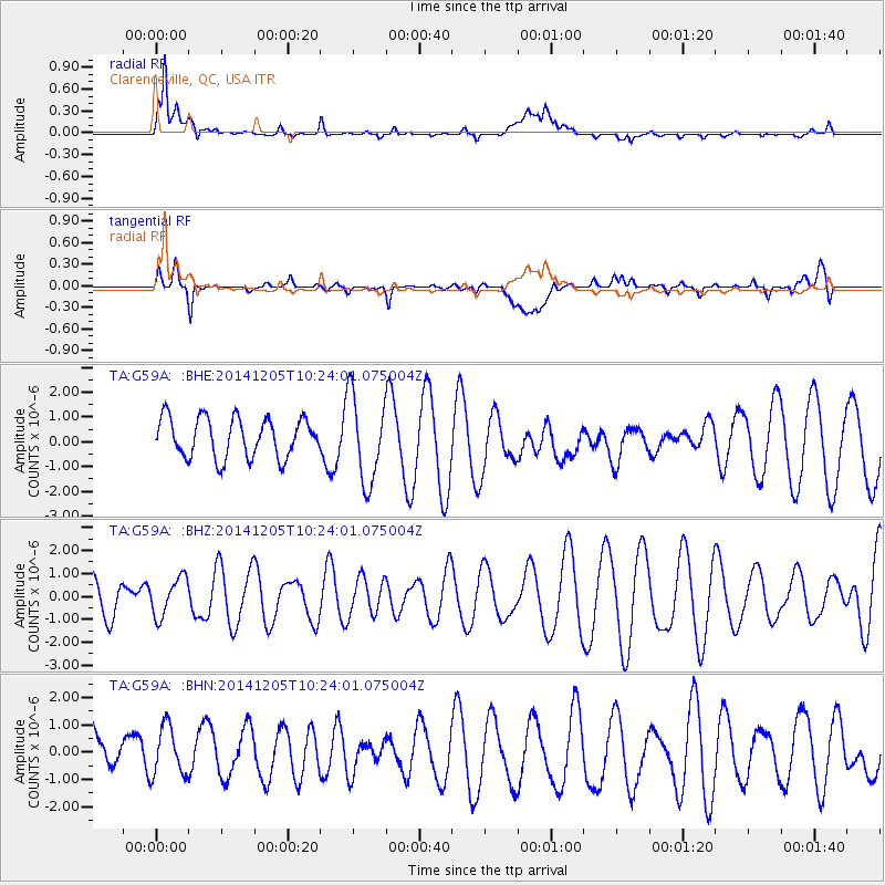
G59A Clarenceville, QC, USA - Earthquake Result Viewer
*The percent match for this event was below the threshold and hence no stack was calculated.
| Earthquake location: |
Near Coast Of Guatemala |
| Earthquake latitude/longitude: |
13.5/-90.9 |
| Earthquake time(UTC): |
2014/12/05 (339) 10:17:42 GMT |
| Earthquake Depth: |
35 km |
| Earthquake Magnitude: |
4.9 MW, 4.8 mb, 5.1 Md |
| Earthquake Catalog/Contributor: |
ISC/ISC |
|
| Network: |
TA USArray Transportable Network (new EarthScope stations) |
| Station: |
G59A Clarenceville, QC, USA |
| Lat/Lon: |
45.08 N/73.18 W |
| Elevation: |
36 m |
|
| Distance: |
34.9 deg |
| Az: |
22.125 deg |
| Baz: |
211.145 deg |
| Ray Param: |
$rayparam |
*The percent match for this event was below the threshold and hence was not used in the summary stack. |
|
| Radial Match: |
81.54117 % |
| Radial Bump: |
400 |
| Transverse Match: |
37.04307 % |
| Transverse Bump: |
400 |
| SOD ConfigId: |
3390531 |
| Insert Time: |
2019-04-15 08:30:27.174 +0000 |
| GWidth: |
2.5 |
| Max Bumps: |
400 |
| Tol: |
0.001 |
|
Signal To Noise
| Channel | StoN | STA | LTA |
| TA:G59A: :BHZ:20141205T10:24:01.075004Z | 1.0828235 | 8.411493E-7 | 7.76811E-7 |
| TA:G59A: :BHN:20141205T10:24:01.075004Z | 0.7312215 | 1.1180874E-6 | 1.5290681E-6 |
| TA:G59A: :BHE:20141205T10:24:01.075004Z | 2.2189124 | 1.7642333E-6 | 7.950892E-7 |
| Arrivals |
| Ps | |
| PpPs | |
| PsPs/PpSs | |


