You are here: Home > Network List > GT - Global Telemetered Seismograph Network (USAF/USGS) Stations List
> Station PLCA Paso Flores, Argentina > Earthquake Result Viewer
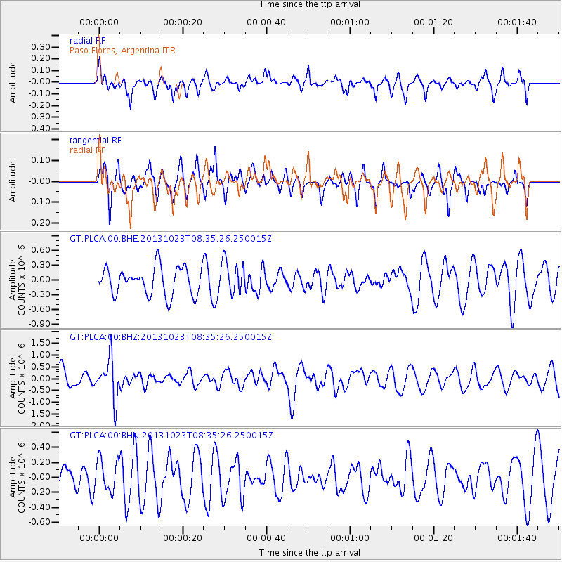
PLCA Paso Flores, Argentina - Earthquake Result Viewer
*The percent match for this event was below the threshold and hence no stack was calculated.
| Earthquake location: |
South Of Fiji Islands |
| Earthquake latitude/longitude: |
-23.0/-177.1 |
| Earthquake time(UTC): |
2013/10/23 (296) 08:23:30 GMT |
| Earthquake Depth: |
160 km |
| Earthquake Magnitude: |
6.0 MWB, 6.0 MWC |
| Earthquake Catalog/Contributor: |
NEIC PDE/NEIC COMCAT |
|
| Network: |
GT Global Telemetered Seismograph Network (USAF/USGS) |
| Station: |
PLCA Paso Flores, Argentina |
| Lat/Lon: |
40.73 S/70.55 W |
| Elevation: |
1050 m |
|
| Distance: |
87.0 deg |
| Az: |
133.173 deg |
| Baz: |
242.161 deg |
| Ray Param: |
$rayparam |
*The percent match for this event was below the threshold and hence was not used in the summary stack. |
|
| Radial Match: |
60.34363 % |
| Radial Bump: |
374 |
| Transverse Match: |
53.789223 % |
| Transverse Bump: |
302 |
| SOD ConfigId: |
626651 |
| Insert Time: |
2014-04-19 05:07:42.545 +0000 |
| GWidth: |
2.5 |
| Max Bumps: |
400 |
| Tol: |
0.001 |
|
Signal To Noise
| Channel | StoN | STA | LTA |
| GT:PLCA:00:BHZ:20131023T08:35:26.250015Z | 2.4838636 | 8.802499E-7 | 3.5438737E-7 |
| GT:PLCA:00:BHN:20131023T08:35:26.250015Z | 0.84564984 | 2.1253952E-7 | 2.5133278E-7 |
| GT:PLCA:00:BHE:20131023T08:35:26.250015Z | 1.1796194 | 3.308042E-7 | 2.8043297E-7 |
| Arrivals |
| Ps | |
| PpPs | |
| PsPs/PpSs | |


