You are here: Home > Network List > TA - USArray Transportable Network (new EarthScope stations) Stations List
> Station J05D Fort Rock, OR, USA > Earthquake Result Viewer
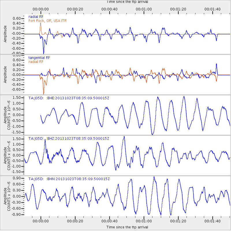
J05D Fort Rock, OR, USA - Earthquake Result Viewer
*The percent match for this event was below the threshold and hence no stack was calculated.
| Earthquake location: |
South Of Fiji Islands |
| Earthquake latitude/longitude: |
-23.0/-177.1 |
| Earthquake time(UTC): |
2013/10/23 (296) 08:23:30 GMT |
| Earthquake Depth: |
160 km |
| Earthquake Magnitude: |
6.0 MWB, 6.0 MWC |
| Earthquake Catalog/Contributor: |
NEIC PDE/NEIC COMCAT |
|
| Network: |
TA USArray Transportable Network (new EarthScope stations) |
| Station: |
J05D Fort Rock, OR, USA |
| Lat/Lon: |
43.28 N/121.23 W |
| Elevation: |
1541 m |
|
| Distance: |
83.6 deg |
| Az: |
37.485 deg |
| Baz: |
230.161 deg |
| Ray Param: |
$rayparam |
*The percent match for this event was below the threshold and hence was not used in the summary stack. |
|
| Radial Match: |
77.53821 % |
| Radial Bump: |
400 |
| Transverse Match: |
75.39497 % |
| Transverse Bump: |
400 |
| SOD ConfigId: |
626651 |
| Insert Time: |
2014-04-19 05:13:04.437 +0000 |
| GWidth: |
2.5 |
| Max Bumps: |
400 |
| Tol: |
0.001 |
|
Signal To Noise
| Channel | StoN | STA | LTA |
| TA:J05D: :BHZ:20131023T08:35:09.500015Z | 1.7448382 | 6.482289E-7 | 3.715123E-7 |
| TA:J05D: :BHN:20131023T08:35:09.500015Z | 0.4254504 | 2.2099772E-7 | 5.1944414E-7 |
| TA:J05D: :BHE:20131023T08:35:09.500015Z | 1.0963268 | 5.075549E-7 | 4.6295952E-7 |
| Arrivals |
| Ps | |
| PpPs | |
| PsPs/PpSs | |


