LPAZ La Paz , Bolivia - Earthquake Result Viewer
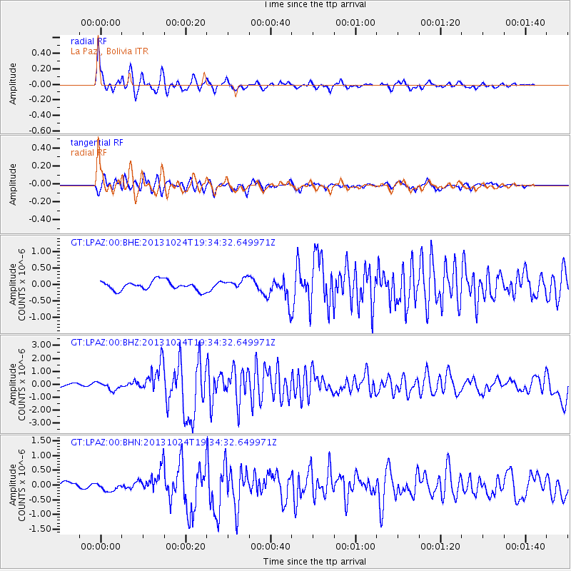
Earthquake location: East Of South Sandwich Islands
Earthquake latitude/longitude: -58.2/-12.8
Earthquake time(UTC): 2013/10/24 (297) 19:25:10 GMT
Earthquake Depth: 23 km
Earthquake Magnitude: 6.7 MWW, 6.5 MI, 6.7 MWC, 6.7 MWW
Earthquake Catalog/Contributor: NEIC PDE/NEIC COMCAT
Network: GT Global Telemetered Seismograph Network (USAF/USGS)
Station: LPAZ La Paz , Bolivia
Lat/Lon: 16.17 S/68.08 W
Elevation: 4817 m
Distance: 58.3 deg
Az: 291.884 deg
Baz: 149.202 deg
Ray Param: 0.06287749
Estimated Moho Depth: 33.0 km
Estimated Crust Vp/Vs: 2.07
Assumed Crust Vp: 6.454 km/s
Estimated Crust Vs: 3.118 km/s
Estimated Crust Poisson's Ratio: 0.35
Radial Match: 92.19384 %
Radial Bump: 397
Transverse Match: 77.434746 %
Transverse Bump: 400
SOD ConfigId: 626651
Insert Time: 2014-04-19 05:31:46.942 +0000
GWidth: 2.5
Max Bumps: 400
Tol: 0.001

Signal To Noise

ChannelStoNSTALTA
GT:LPAZ:00:BHZ:20131024T19:34:32.649971Z2.4731152.9413627E-71.1893352E-7
GT:LPAZ:00:BHN:20131024T19:34:32.649971Z1.5505781.3938764E-78.989398E-8
GT:LPAZ:00:BHE:20131024T19:34:32.649971Z1.2846361.8413132E-71.4333345E-7
Arrivals
Ps5.7 SECOND
PpPs15 SECOND
PsPs/PpSs21 SECOND