SMER AZ.SMER - Earthquake Result Viewer
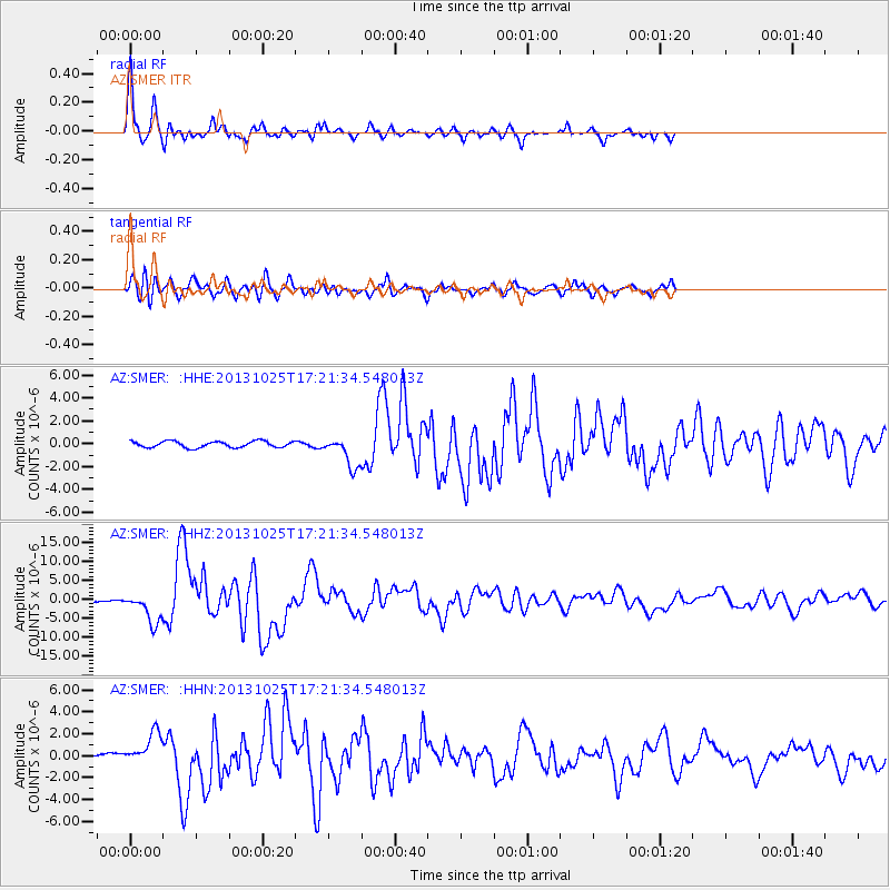
Earthquake location: Off East Coast Of Honshu, Japan
Earthquake latitude/longitude: 37.2/144.7
Earthquake time(UTC): 2013/10/25 (298) 17:10:19 GMT
Earthquake Depth: 35 km
Earthquake Magnitude: 7.1 MWW, 7.1 MWW, 7.1 MWB, 7.1 MWC, 7.2 MWC, 7.5 MI
Earthquake Catalog/Contributor: NEIC PDE/NEIC COMCAT
Network: AZ ANZA Regional Network
Station: SMER AZ.SMER
Lat/Lon: 33.46 N/117.17 W
Elevation: 355 m
Distance: 76.4 deg
Az: 58.362 deg
Baz: 305.546 deg
Ray Param: 0.05096811
Estimated Moho Depth: 33.75 km
Estimated Crust Vp/Vs: 1.68
Assumed Crust Vp: 6.264 km/s
Estimated Crust Vs: 3.734 km/s
Estimated Crust Poisson's Ratio: 0.22
Radial Match: 92.47466 %
Radial Bump: 397
Transverse Match: 88.81332 %
Transverse Bump: 400
SOD ConfigId: 626651
Insert Time: 2014-04-19 05:41:36.776 +0000
GWidth: 2.5
Max Bumps: 400
Tol: 0.001

Signal To Noise

ChannelStoNSTALTA
AZ:SMER: :HHZ:20131025T17:21:34.548013Z29.7098874.005765E-61.3482935E-7
AZ:SMER: :HHN:20131025T17:21:34.548013Z9.2404231.5380309E-61.6644593E-7
AZ:SMER: :HHE:20131025T17:21:34.548013Z4.91473151.3347887E-62.7158936E-7
Arrivals
Ps3.8 SECOND
PpPs14 SECOND
PsPs/PpSs18 SECOND