FRB IQALUIT, N.W.T. - Earthquake Result Viewer
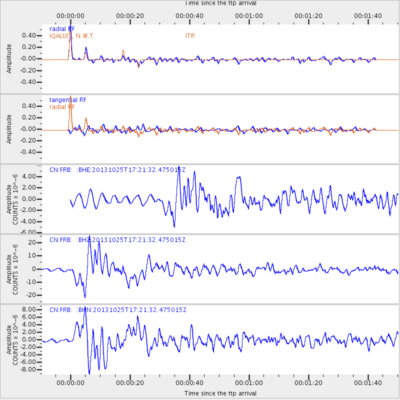
Earthquake location: Off East Coast Of Honshu, Japan
Earthquake latitude/longitude: 37.2/144.7
Earthquake time(UTC): 2013/10/25 (298) 17:10:19 GMT
Earthquake Depth: 35 km
Earthquake Magnitude: 7.1 MWW, 7.1 MWW, 7.1 MWB, 7.1 MWC, 7.2 MWC, 7.5 MI
Earthquake Catalog/Contributor: NEIC PDE/NEIC COMCAT
Network: CN Canadian National Seismograph Network
Station: FRB IQALUIT, N.W.T.
Lat/Lon: 63.75 N/68.55 W
Elevation: 18 m
Distance: 76.0 deg
Az: 14.536 deg
Baz: 333.199 deg
Ray Param: 0.051215615
Estimated Moho Depth: 42.25 km
Estimated Crust Vp/Vs: 1.78
Assumed Crust Vp: 6.419 km/s
Estimated Crust Vs: 3.606 km/s
Estimated Crust Poisson's Ratio: 0.27
Radial Match: 95.867676 %
Radial Bump: 319
Transverse Match: 77.36772 %
Transverse Bump: 400
SOD ConfigId: 626651
Insert Time: 2014-04-19 05:45:04.494 +0000
GWidth: 2.5
Max Bumps: 400
Tol: 0.001

Signal To Noise

ChannelStoNSTALTA
CN:FRB: :BHZ:20131025T17:21:32.475015Z8.4213668.514726E-61.0110862E-6
CN:FRB: :BHN:20131025T17:21:32.475015Z13.1175053.354274E-62.5570975E-7
CN:FRB: :BHE:20131025T17:21:32.475015Z2.34814741.8315453E-67.7999596E-7
Arrivals
Ps5.3 SECOND
PpPs18 SECOND
PsPs/PpSs23 SECOND