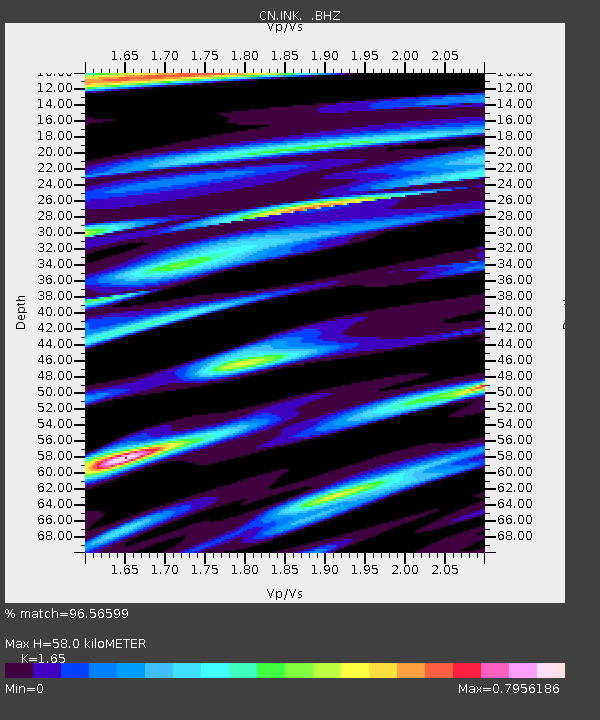
INK INUVIK, NT - Earthquake Result Viewer
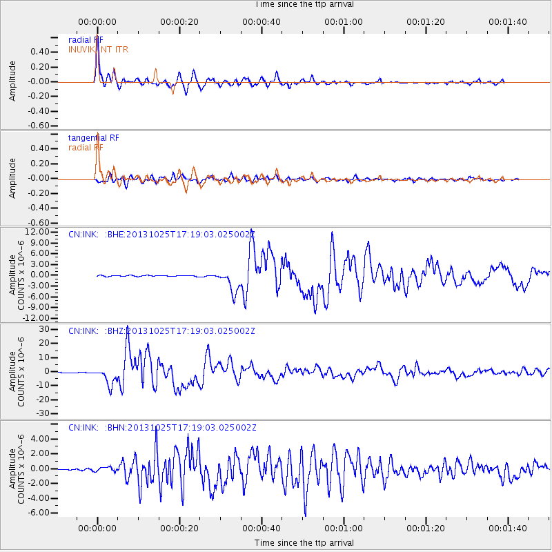
Earthquake location: Off East Coast Of Honshu, Japan
Earthquake latitude/longitude: 37.2/144.7
Earthquake time(UTC): 2013/10/25 (298) 17:10:19 GMT
Earthquake Depth: 35 km
Earthquake Magnitude: 7.1 MWW, 7.1 MWW, 7.1 MWB, 7.1 MWC, 7.2 MWC, 7.5 MI
Earthquake Catalog/Contributor: NEIC PDE/NEIC COMCAT
Network: CN Canadian National Seismograph Network
Station: INK INUVIK, NT
Lat/Lon: 68.31 N/133.53 W
Elevation: 44 m
Distance: 53.1 deg
Az: 27.404 deg
Baz: 278.486 deg
Ray Param: 0.06626608
Estimated Moho Depth: 58.0 km
Estimated Crust Vp/Vs: 1.65
Assumed Crust Vp: 6.171 km/s
Estimated Crust Vs: 3.74 km/s
Estimated Crust Poisson's Ratio: 0.21
Radial Match: 96.56599 %
Radial Bump: 400
Transverse Match: 90.46441 %
Transverse Bump: 400
SOD ConfigId: 626651
Insert Time: 2014-04-19 05:45:10.490 +0000
GWidth: 2.5
Max Bumps: 400
Tol: 0.001

Signal To Noise

ChannelStoNSTALTA
CN:INK: :BHZ:20131025T17:19:03.025002Z33.534946.3492803E-61.8933329E-7
CN:INK: :BHN:20131025T17:19:03.025002Z1.63007743.211341E-71.9700545E-7
CN:INK: :BHE:20131025T17:19:03.025002Z24.4217453.2718217E-61.3397165E-7
Arrivals
Ps6.4 SECOND
PpPs24 SECOND
PsPs/PpSs30 SECOND