WHY Whitehorse, YT - Earthquake Result Viewer
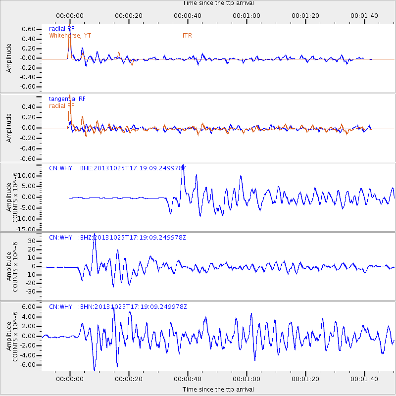
Earthquake location: Off East Coast Of Honshu, Japan
Earthquake latitude/longitude: 37.2/144.7
Earthquake time(UTC): 2013/10/25 (298) 17:10:19 GMT
Earthquake Depth: 35 km
Earthquake Magnitude: 7.1 MWW, 7.1 MWW, 7.1 MWB, 7.1 MWC, 7.2 MWC, 7.5 MI
Earthquake Catalog/Contributor: NEIC PDE/NEIC COMCAT
Network: CN Canadian National Seismograph Network
Station: WHY Whitehorse, YT
Lat/Lon: 60.66 N/134.88 W
Elevation: 1292 m
Distance: 53.9 deg
Az: 36.927 deg
Baz: 282.933 deg
Ray Param: 0.06569561
Estimated Moho Depth: 11.0 km
Estimated Crust Vp/Vs: 1.72
Assumed Crust Vp: 6.419 km/s
Estimated Crust Vs: 3.738 km/s
Estimated Crust Poisson's Ratio: 0.24
Radial Match: 94.9081 %
Radial Bump: 400
Transverse Match: 90.16251 %
Transverse Bump: 400
SOD ConfigId: 626651
Insert Time: 2014-04-19 05:46:12.456 +0000
GWidth: 2.5
Max Bumps: 400
Tol: 0.001

Signal To Noise

ChannelStoNSTALTA
CN:WHY: :BHZ:20131025T17:19:09.249978Z33.8343775.7130096E-61.6885222E-7
CN:WHY: :BHN:20131025T17:19:09.249978Z5.5513041.0947546E-61.9720675E-7
CN:WHY: :BHE:20131025T17:19:09.249978Z17.954012.8531028E-61.5891173E-7
Arrivals
Ps1.3 SECOND
PpPs4.4 SECOND
PsPs/PpSs5.7 SECOND