
KEV Kevo, Finland - Earthquake Result Viewer
| ||||||||||||||||||
| ||||||||||||||||||
| ||||||||||||||||||
|
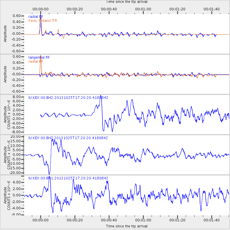
Signal To Noise
| Channel | StoN | STA | LTA |
| IU:KEV:00:BHZ:20131025T17:20:20.418984Z | 14.819968 | 8.429782E-6 | 5.688124E-7 |
| IU:KEV:00:BH1:20131025T17:20:20.418984Z | 4.661343 | 2.0306663E-6 | 4.3563972E-7 |
| IU:KEV:00:BH2:20131025T17:20:20.418984Z | 7.122246 | 3.3244041E-6 | 4.6676345E-7 |
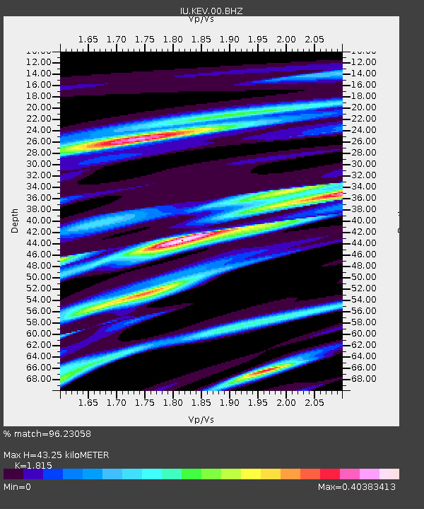
| Arrivals | |
| Ps | 5.6 SECOND |
| PpPs | 18 SECOND |
| PsPs/PpSs | 23 SECOND |

