MOOW Moose Ponds, Wyoming, USA - Earthquake Result Viewer
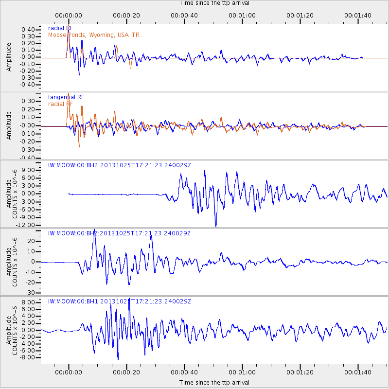
Earthquake location: Off East Coast Of Honshu, Japan
Earthquake latitude/longitude: 37.2/144.7
Earthquake time(UTC): 2013/10/25 (298) 17:10:19 GMT
Earthquake Depth: 35 km
Earthquake Magnitude: 7.1 MWW, 7.1 MWW, 7.1 MWB, 7.1 MWC, 7.2 MWC, 7.5 MI
Earthquake Catalog/Contributor: NEIC PDE/NEIC COMCAT
Network: IW Intermountain West
Station: MOOW Moose Ponds, Wyoming, USA
Lat/Lon: 43.75 N/110.74 W
Elevation: 2128 m
Distance: 74.4 deg
Az: 46.723 deg
Baz: 306.617 deg
Ray Param: 0.05229067
Estimated Moho Depth: 11.5 km
Estimated Crust Vp/Vs: 1.60
Assumed Crust Vp: 6.207 km/s
Estimated Crust Vs: 3.879 km/s
Estimated Crust Poisson's Ratio: 0.18
Radial Match: 97.43308 %
Radial Bump: 400
Transverse Match: 93.91705 %
Transverse Bump: 400
SOD ConfigId: 626651
Insert Time: 2014-04-19 05:52:51.593 +0000
GWidth: 2.5
Max Bumps: 400
Tol: 0.001

Signal To Noise

ChannelStoNSTALTA
IW:MOOW:00:BHZ:20131025T17:21:23.240029Z15.9659723.5417743E-62.2183266E-7
IW:MOOW:00:BH1:20131025T17:21:23.240029Z4.1184497.1975353E-71.7476323E-7
IW:MOOW:00:BH2:20131025T17:21:23.240029Z7.50730137.1604916E-79.5380365E-8
Arrivals
Ps1.2 SECOND
PpPs4.7 SECOND
PsPs/PpSs5.8 SECOND