
TUPA Temple University, Pennsylvania - Earthquake Result Viewer
| ||||||||||||||||||
| ||||||||||||||||||
| ||||||||||||||||||
|
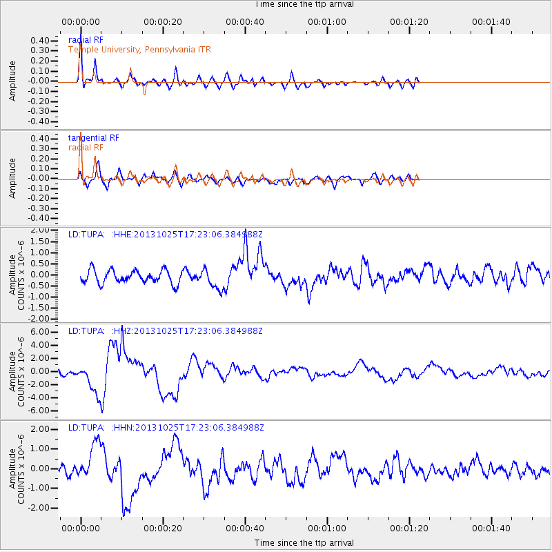
Signal To Noise
| Channel | StoN | STA | LTA |
| LD:TUPA: :HHZ:20131025T17:23:06.384988Z | 5.6813293 | 2.3436512E-6 | 4.1251815E-7 |
| LD:TUPA: :HHN:20131025T17:23:06.384988Z | 4.6127696 | 9.679635E-7 | 2.0984433E-7 |
| LD:TUPA: :HHE:20131025T17:23:06.384988Z | 1.5993098 | 4.5816049E-7 | 2.864739E-7 |
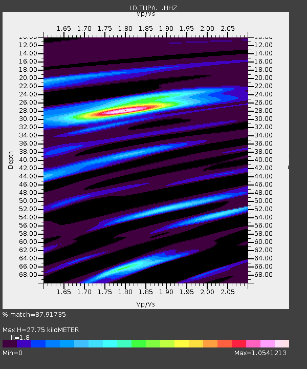
| Arrivals | |
| Ps | 3.6 SECOND |
| PpPs | 12 SECOND |
| PsPs/PpSs | 16 SECOND |

