WRPS We R Penn State - Earthquake Result Viewer
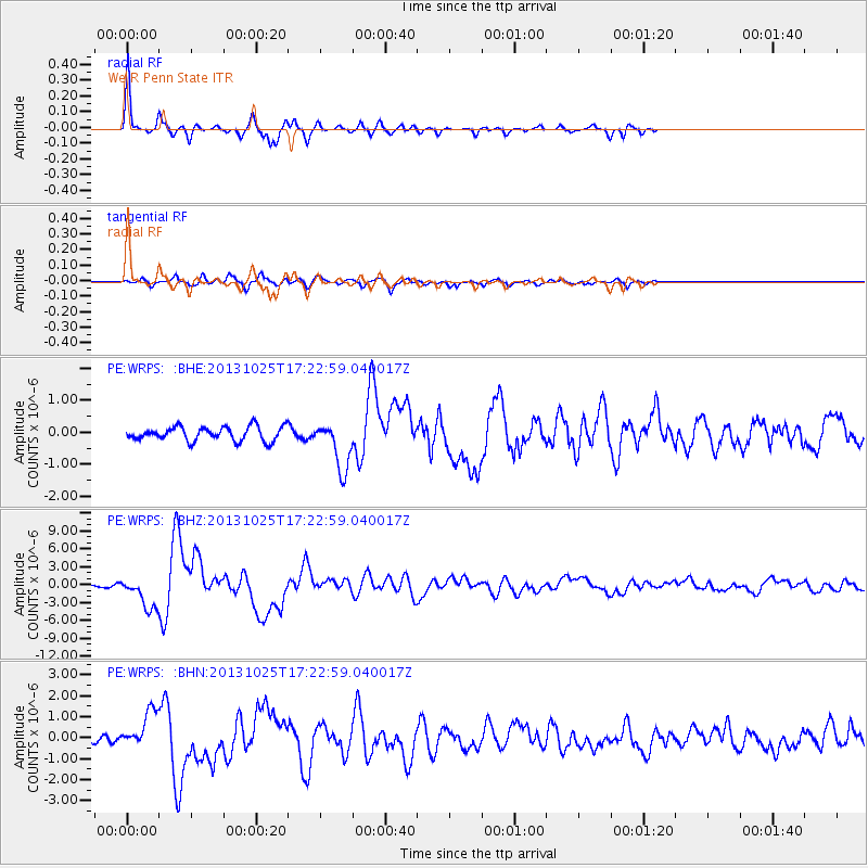
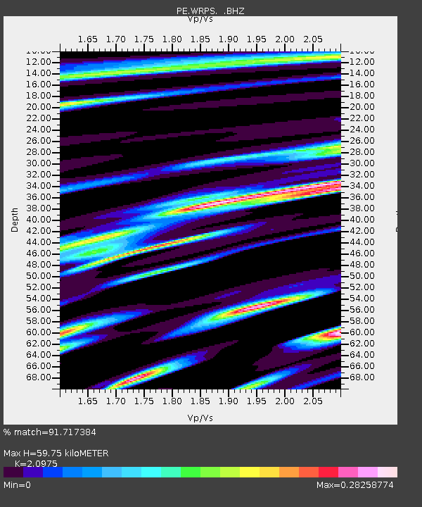
Earthquake location: Off East Coast Of Honshu, Japan
Earthquake latitude/longitude: 37.2/144.7
Earthquake time(UTC): 2013/10/25 (298) 17:10:19 GMT
Earthquake Depth: 35 km
Earthquake Magnitude: 7.1 MWW, 7.1 MWW, 7.1 MWB, 7.1 MWC, 7.2 MWC, 7.5 MI
Earthquake Catalog/Contributor: NEIC PDE/NEIC COMCAT
Network: PE Penn State Network
Station: WRPS We R Penn State
Lat/Lon: 40.79 N/77.87 W
Elevation: 320 m
Distance: 93.2 deg
Az: 30.929 deg
Baz: 327.257 deg
Ray Param: 0.041298173
Estimated Moho Depth: 59.75 km
Estimated Crust Vp/Vs: 2.10
Assumed Crust Vp: 6.121 km/s
Estimated Crust Vs: 2.918 km/s
Estimated Crust Poisson's Ratio: 0.35
Radial Match: 91.717384 %
Radial Bump: 206
Transverse Match: 61.484955 %
Transverse Bump: 400
SOD ConfigId: 626651
Insert Time: 2014-04-19 05:58:48.822 +0000
GWidth: 2.5
Max Bumps: 400
Tol: 0.001

Signal To Noise

ChannelStoNSTALTA
PE:WRPS: :BHZ:20131025T17:22:59.040017Z15.8491812.664785E-61.6813391E-7
PE:WRPS: :BHN:20131025T17:22:59.040017Z4.40181978.9015293E-72.0222384E-7
PE:WRPS: :BHE:20131025T17:22:59.040017Z3.48045567.6205873E-72.1895372E-7
Arrivals
Ps11 SECOND
PpPs30 SECOND
PsPs/PpSs41 SECOND