109C Camp Elliot, Mirimar, CA, USA - Earthquake Result Viewer
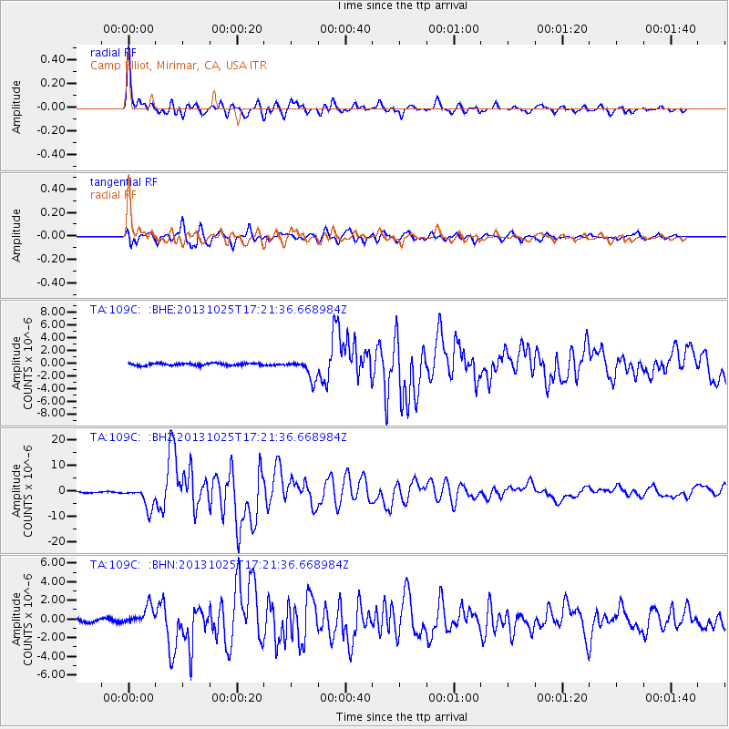
Earthquake location: Off East Coast Of Honshu, Japan
Earthquake latitude/longitude: 37.2/144.7
Earthquake time(UTC): 2013/10/25 (298) 17:10:19 GMT
Earthquake Depth: 35 km
Earthquake Magnitude: 7.1 MWW, 7.1 MWW, 7.1 MWB, 7.1 MWC, 7.2 MWC, 7.5 MI
Earthquake Catalog/Contributor: NEIC PDE/NEIC COMCAT
Network: TA USArray Transportable Network (new EarthScope stations)
Station: 109C Camp Elliot, Mirimar, CA, USA
Lat/Lon: 32.89 N/117.11 W
Elevation: 150 m
Distance: 76.8 deg
Az: 58.803 deg
Baz: 305.684 deg
Ray Param: 0.050716396
Estimated Moho Depth: 20.0 km
Estimated Crust Vp/Vs: 1.62
Assumed Crust Vp: 6.264 km/s
Estimated Crust Vs: 3.866 km/s
Estimated Crust Poisson's Ratio: 0.19
Radial Match: 95.18277 %
Radial Bump: 400
Transverse Match: 89.761894 %
Transverse Bump: 400
SOD ConfigId: 626651
Insert Time: 2014-04-19 06:02:37.751 +0000
GWidth: 2.5
Max Bumps: 400
Tol: 0.001

Signal To Noise

ChannelStoNSTALTA
TA:109C: :BHZ:20131025T17:21:36.668984Z13.1052354.4074854E-63.3631486E-7
TA:109C: :BHN:20131025T17:21:36.668984Z3.1659161.011122E-63.193774E-7
TA:109C: :BHE:20131025T17:21:36.668984Z9.2216471.600559E-61.7356541E-7
Arrivals
Ps2.0 SECOND
PpPs8.1 SECOND
PsPs/PpSs10 SECOND