
153A Fort Valley, GA, USA - Earthquake Result Viewer
| ||||||||||||||||||
| ||||||||||||||||||
| ||||||||||||||||||
|
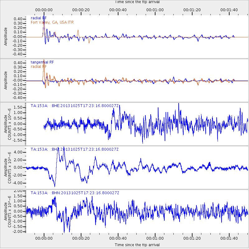
Signal To Noise
| Channel | StoN | STA | LTA |
| TA:153A: :BHZ:20131025T17:23:16.800027Z | 7.739522 | 1.5946367E-6 | 2.0603815E-7 |
| TA:153A: :BHN:20131025T17:23:16.800027Z | 2.0617404 | 4.7100892E-7 | 2.284521E-7 |
| TA:153A: :BHE:20131025T17:23:16.800027Z | 1.6743526 | 4.1043322E-7 | 2.451295E-7 |
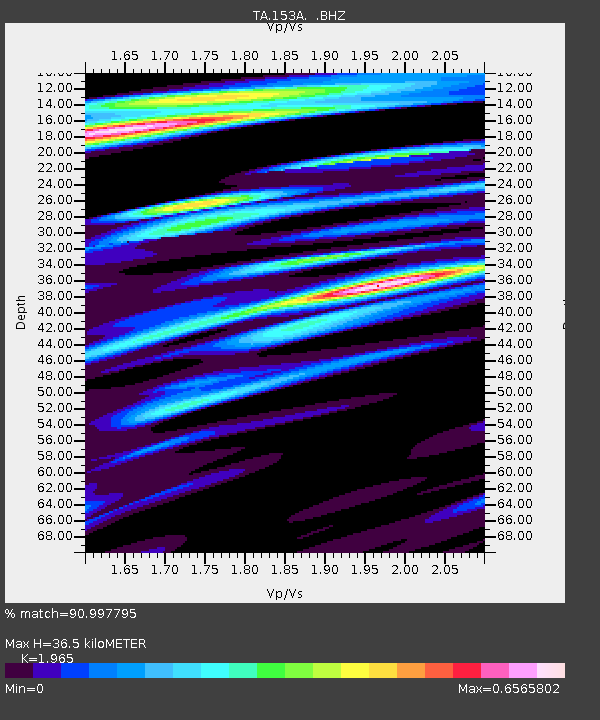
| Arrivals | |
| Ps | 5.5 SECOND |
| PpPs | 16 SECOND |
| PsPs/PpSs | 22 SECOND |

