
154A Montrose, GA, USA - Earthquake Result Viewer
| ||||||||||||||||||
| ||||||||||||||||||
| ||||||||||||||||||
|
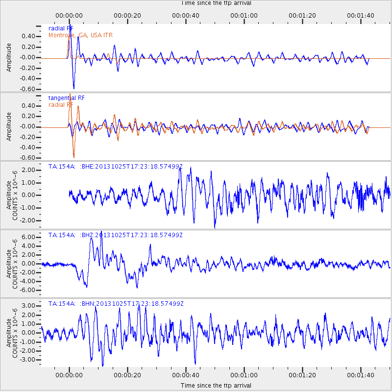
Signal To Noise
| Channel | StoN | STA | LTA |
| TA:154A: :BHZ:20131025T17:23:18.57499Z | 7.46628 | 1.5857893E-6 | 2.1239349E-7 |
| TA:154A: :BHN:20131025T17:23:18.57499Z | 1.9838554 | 7.9602495E-7 | 4.012515E-7 |
| TA:154A: :BHE:20131025T17:23:18.57499Z | 1.7422619 | 6.0356246E-7 | 3.4642463E-7 |
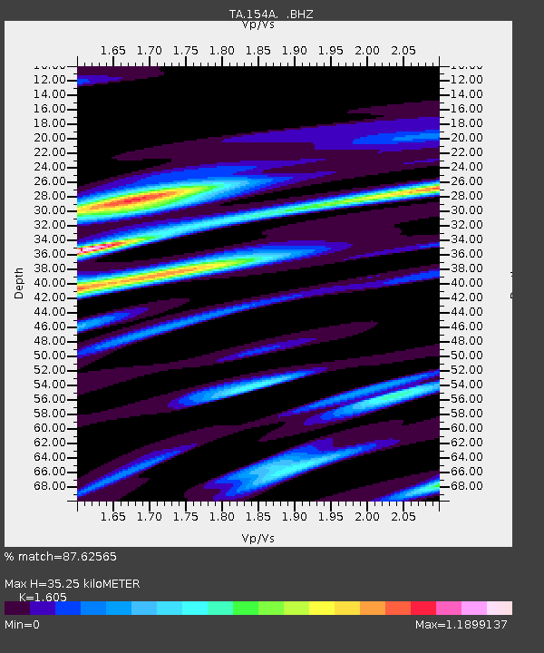
| Arrivals | |
| Ps | 3.3 SECOND |
| PpPs | 14 SECOND |
| PsPs/PpSs | 17 SECOND |

