
D41A Chassel, MI, USA - Earthquake Result Viewer
| ||||||||||||||||||
| ||||||||||||||||||
| ||||||||||||||||||
|
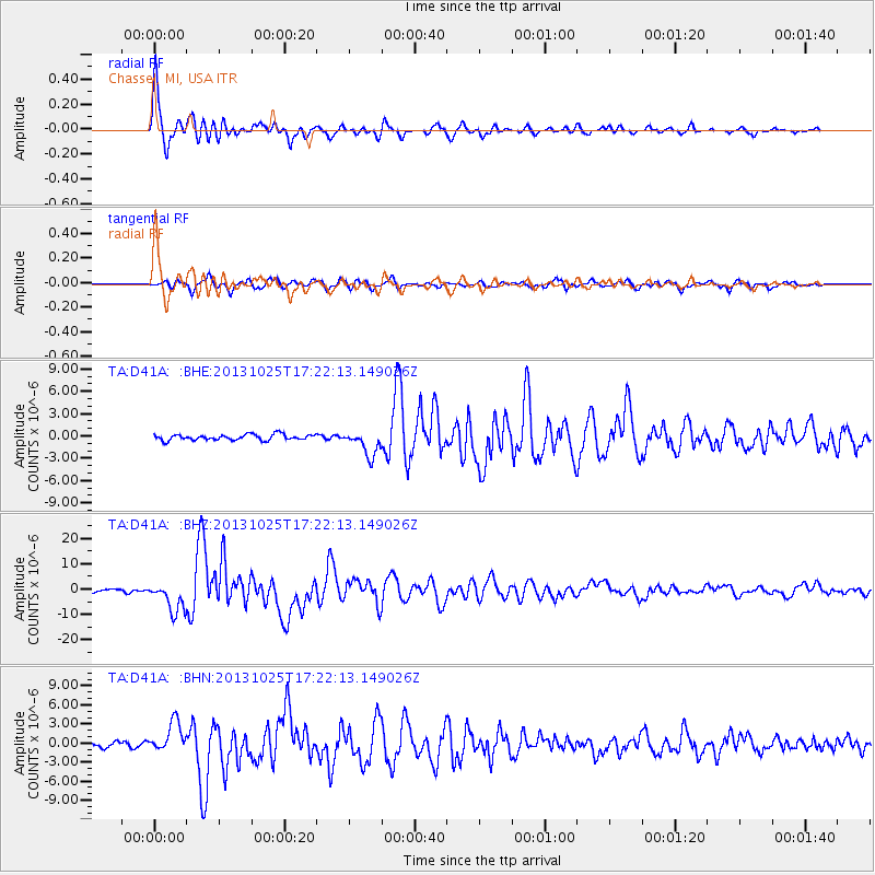
Signal To Noise
| Channel | StoN | STA | LTA |
| TA:D41A: :BHZ:20131025T17:22:13.149026Z | 14.0034485 | 5.85279E-6 | 4.1795346E-7 |
| TA:D41A: :BHN:20131025T17:22:13.149026Z | 5.7671757 | 2.3804303E-6 | 4.1275493E-7 |
| TA:D41A: :BHE:20131025T17:22:13.149026Z | 4.3816485 | 1.6971833E-6 | 3.87339E-7 |
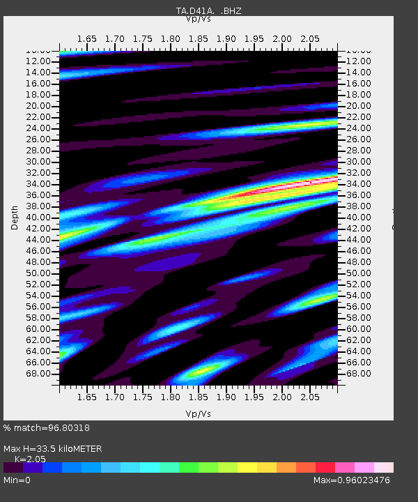
| Arrivals | |
| Ps | 5.6 SECOND |
| PpPs | 15 SECOND |
| PsPs/PpSs | 21 SECOND |

