D50A G1974 Best Township, ON, CAN - Earthquake Result Viewer
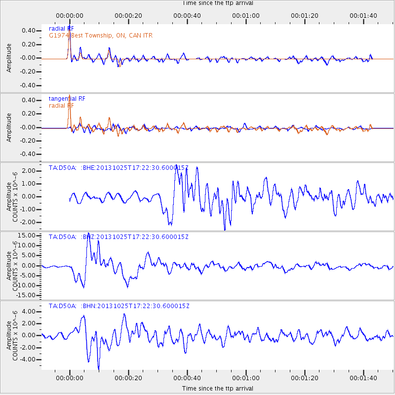
Earthquake location: Off East Coast Of Honshu, Japan
Earthquake latitude/longitude: 37.2/144.7
Earthquake time(UTC): 2013/10/25 (298) 17:10:19 GMT
Earthquake Depth: 35 km
Earthquake Magnitude: 7.1 MWW, 7.1 MWW, 7.1 MWB, 7.1 MWC, 7.2 MWC, 7.5 MI
Earthquake Catalog/Contributor: NEIC PDE/NEIC COMCAT
Network: TA USArray Transportable Network (new EarthScope stations)
Station: D50A G1974 Best Township, ON, CAN
Lat/Lon: 47.17 N/79.84 W
Elevation: 331 m
Distance: 87.1 deg
Az: 28.612 deg
Baz: 325.893 deg
Ray Param: 0.043532427
Estimated Moho Depth: 33.75 km
Estimated Crust Vp/Vs: 1.68
Assumed Crust Vp: 6.622 km/s
Estimated Crust Vs: 3.954 km/s
Estimated Crust Poisson's Ratio: 0.22
Radial Match: 91.84542 %
Radial Bump: 400
Transverse Match: 77.580345 %
Transverse Bump: 400
SOD ConfigId: 626651
Insert Time: 2014-04-19 06:04:01.086 +0000
GWidth: 2.5
Max Bumps: 400
Tol: 0.001

Signal To Noise

ChannelStoNSTALTA
TA:D50A: :BHZ:20131025T17:22:30.600015Z14.6795885.488789E-63.739062E-7
TA:D50A: :BHN:20131025T17:22:30.600015Z4.86242441.6291615E-63.3505128E-7
TA:D50A: :BHE:20131025T17:22:30.600015Z4.62148951.183323E-62.5604797E-7
Arrivals
Ps3.5 SECOND
PpPs13 SECOND
PsPs/PpSs17 SECOND