E04D Cinebar, WA, USA - Earthquake Result Viewer
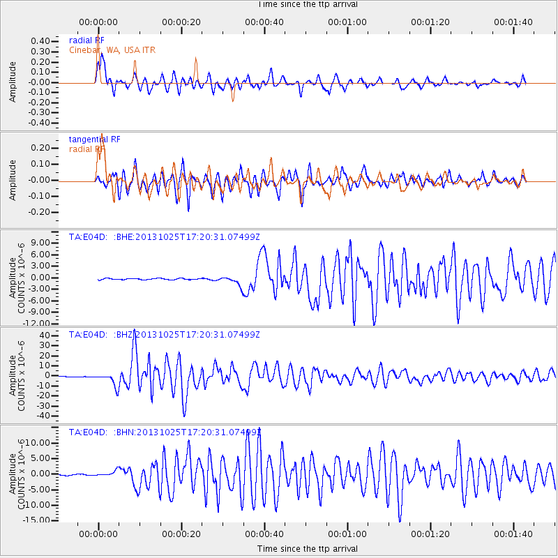
Earthquake location: Off East Coast Of Honshu, Japan
Earthquake latitude/longitude: 37.2/144.7
Earthquake time(UTC): 2013/10/25 (298) 17:10:19 GMT
Earthquake Depth: 35 km
Earthquake Magnitude: 7.1 MWW, 7.1 MWW, 7.1 MWB, 7.1 MWC, 7.2 MWC, 7.5 MI
Earthquake Catalog/Contributor: NEIC PDE/NEIC COMCAT
Network: TA USArray Transportable Network (new EarthScope stations)
Station: E04D Cinebar, WA, USA
Lat/Lon: 46.56 N/122.57 W
Elevation: 204 m
Distance: 65.9 deg
Az: 49.041 deg
Baz: 299.034 deg
Ray Param: 0.05792228
Estimated Moho Depth: 15.5 km
Estimated Crust Vp/Vs: 1.61
Assumed Crust Vp: 6.566 km/s
Estimated Crust Vs: 4.091 km/s
Estimated Crust Poisson's Ratio: 0.18
Radial Match: 91.77794 %
Radial Bump: 400
Transverse Match: 85.150536 %
Transverse Bump: 400
SOD ConfigId: 626651
Insert Time: 2014-04-19 06:04:34.154 +0000
GWidth: 2.5
Max Bumps: 400
Tol: 0.001

Signal To Noise

ChannelStoNSTALTA
TA:E04D: :BHZ:20131025T17:20:31.07499Z33.9580766.8375775E-62.013535E-7
TA:E04D: :BHN:20131025T17:20:31.07499Z6.36566079.447473E-71.4841308E-7
TA:E04D: :BHE:20131025T17:20:31.07499Z7.5904091.2745057E-61.6791003E-7
Arrivals
Ps1.5 SECOND
PpPs5.9 SECOND
PsPs/PpSs7.4 SECOND