
E43A Lone Tree Farm, Eben Junction, MI, USA - Earthquake Result Viewer
| ||||||||||||||||||
| ||||||||||||||||||
| ||||||||||||||||||
|
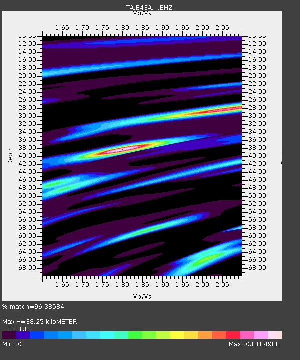
Signal To Noise
| Channel | StoN | STA | LTA |
| TA:E43A: :BHZ:20131025T17:22:19.300027Z | 17.218725 | 5.5136065E-6 | 3.2020992E-7 |
| TA:E43A: :BHN:20131025T17:22:19.300027Z | 10.773542 | 1.638967E-6 | 1.5212889E-7 |
| TA:E43A: :BHE:20131025T17:22:19.300027Z | 5.786608 | 1.3707456E-6 | 2.3688241E-7 |
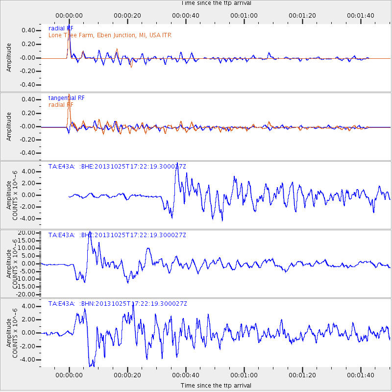
| Arrivals | |
| Ps | 4.8 SECOND |
| PpPs | 16 SECOND |
| PsPs/PpSs | 21 SECOND |

