
E44A Grand Marais Airport, Grand Marais, MI, USA - Earthquake Result Viewer
| ||||||||||||||||||
| ||||||||||||||||||
| ||||||||||||||||||
|
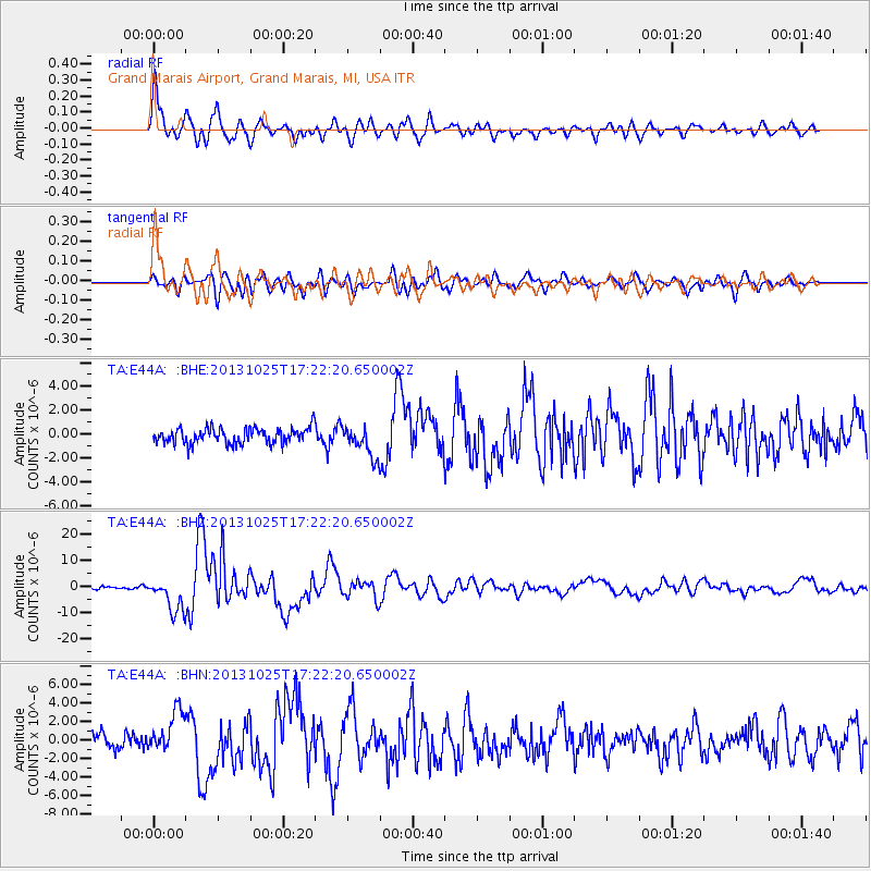
Signal To Noise
| Channel | StoN | STA | LTA |
| TA:E44A: :BHZ:20131025T17:22:20.650002Z | 9.486631 | 6.446683E-6 | 6.795545E-7 |
| TA:E44A: :BHN:20131025T17:22:20.650002Z | 2.914866 | 2.2218774E-6 | 7.622571E-7 |
| TA:E44A: :BHE:20131025T17:22:20.650002Z | 1.9902478 | 1.2885454E-6 | 6.474296E-7 |
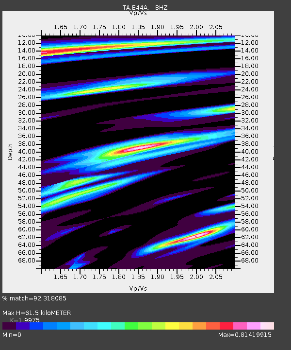
| Arrivals | |
| Ps | 9.7 SECOND |
| PpPs | 28 SECOND |
| PsPs/PpSs | 38 SECOND |

