
E48A Lockeyer, ON, CAN - Earthquake Result Viewer
| ||||||||||||||||||
| ||||||||||||||||||
| ||||||||||||||||||
|
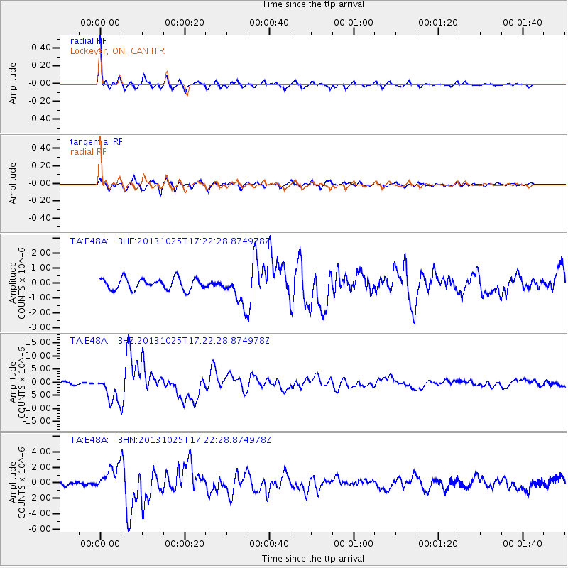
Signal To Noise
| Channel | StoN | STA | LTA |
| TA:E48A: :BHZ:20131025T17:22:28.874978Z | 12.561327 | 5.1524325E-6 | 4.1018217E-7 |
| TA:E48A: :BHN:20131025T17:22:28.874978Z | 6.7395606 | 1.6308587E-6 | 2.4198295E-7 |
| TA:E48A: :BHE:20131025T17:22:28.874978Z | 2.8328364 | 1.0580919E-6 | 3.7350972E-7 |
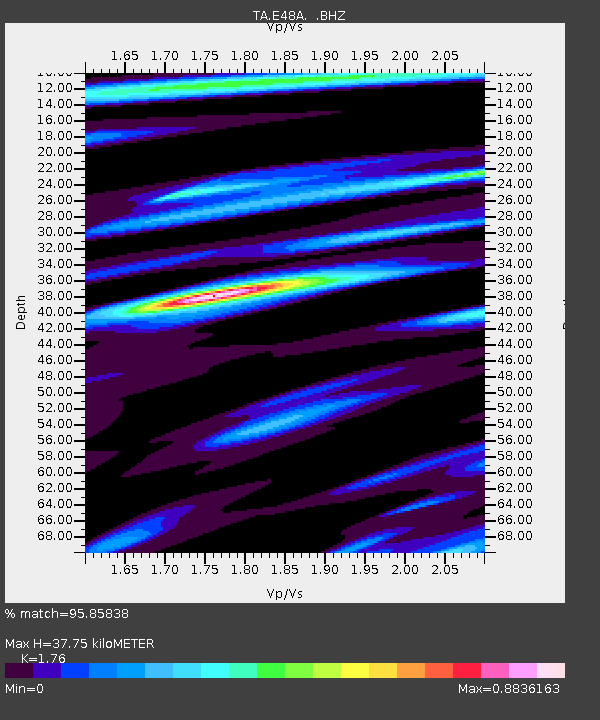
| Arrivals | |
| Ps | 4.5 SECOND |
| PpPs | 16 SECOND |
| PsPs/PpSs | 20 SECOND |

