E62A Clayton Lake, ME, USA - Earthquake Result Viewer
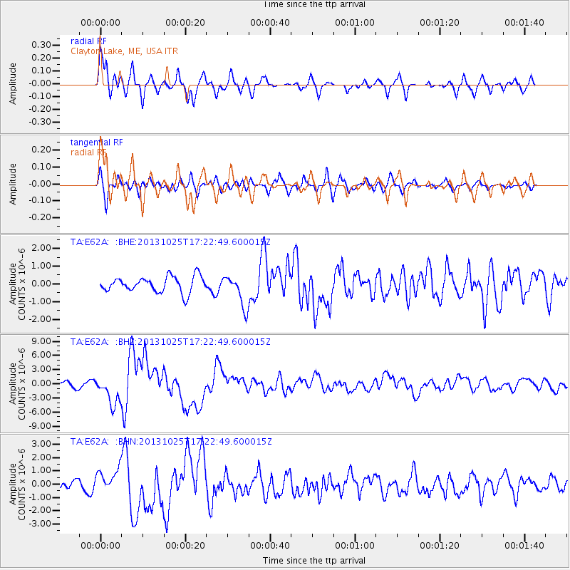
Earthquake location: Off East Coast Of Honshu, Japan
Earthquake latitude/longitude: 37.2/144.7
Earthquake time(UTC): 2013/10/25 (298) 17:10:19 GMT
Earthquake Depth: 35 km
Earthquake Magnitude: 7.1 MWW, 7.1 MWW, 7.1 MWB, 7.1 MWC, 7.2 MWC, 7.5 MI
Earthquake Catalog/Contributor: NEIC PDE/NEIC COMCAT
Network: TA USArray Transportable Network (new EarthScope stations)
Station: E62A Clayton Lake, ME, USA
Lat/Lon: 46.62 N/69.52 W
Elevation: 356 m
Distance: 91.1 deg
Az: 22.789 deg
Baz: 333.322 deg
Ray Param: 0.04161926
Estimated Moho Depth: 11.5 km
Estimated Crust Vp/Vs: 1.74
Assumed Crust Vp: 6.419 km/s
Estimated Crust Vs: 3.695 km/s
Estimated Crust Poisson's Ratio: 0.25
Radial Match: 81.78718 %
Radial Bump: 400
Transverse Match: 70.56616 %
Transverse Bump: 400
SOD ConfigId: 626651
Insert Time: 2014-04-19 06:05:20.509 +0000
GWidth: 2.5
Max Bumps: 400
Tol: 0.001

Signal To Noise

ChannelStoNSTALTA
TA:E62A: :BHZ:20131025T17:22:49.600015Z4.58792833.1270376E-66.815795E-7
TA:E62A: :BHN:20131025T17:22:49.600015Z2.2456939.5099705E-74.23476E-7
TA:E62A: :BHE:20131025T17:22:49.600015Z2.09852939.3381914E-74.4498745E-7
Arrivals
Ps1.3 SECOND
PpPs4.8 SECOND
PsPs/PpSs6.2 SECOND