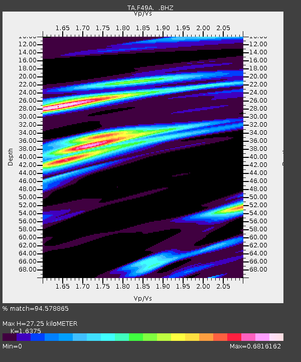
F49A Sandfield, ON, CAN - Earthquake Result Viewer
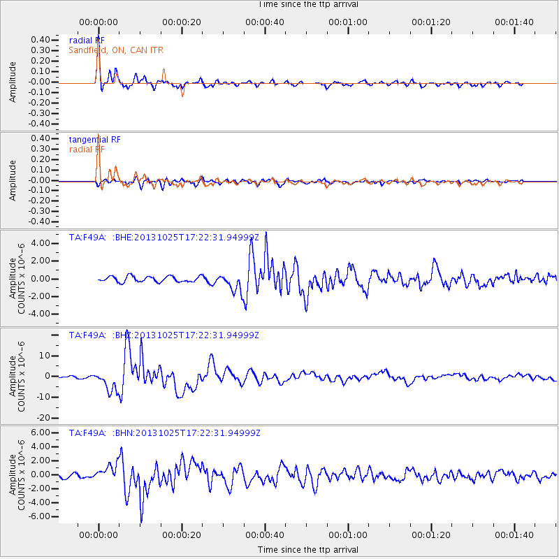
Earthquake location: Off East Coast Of Honshu, Japan
Earthquake latitude/longitude: 37.2/144.7
Earthquake time(UTC): 2013/10/25 (298) 17:10:19 GMT
Earthquake Depth: 35 km
Earthquake Magnitude: 7.1 MWW, 7.1 MWW, 7.1 MWB, 7.1 MWC, 7.2 MWC, 7.5 MI
Earthquake Catalog/Contributor: NEIC PDE/NEIC COMCAT
Network: TA USArray Transportable Network (new EarthScope stations)
Station: F49A Sandfield, ON, CAN
Lat/Lon: 45.76 N/82.04 W
Elevation: 230 m
Distance: 87.4 deg
Az: 30.666 deg
Baz: 324.402 deg
Ray Param: 0.043330215
Estimated Moho Depth: 27.25 km
Estimated Crust Vp/Vs: 1.64
Assumed Crust Vp: 6.483 km/s
Estimated Crust Vs: 3.959 km/s
Estimated Crust Poisson's Ratio: 0.20
Radial Match: 94.578865 %
Radial Bump: 325
Transverse Match: 78.92053 %
Transverse Bump: 400
SOD ConfigId: 626651
Insert Time: 2014-04-19 06:05:47.003 +0000
GWidth: 2.5
Max Bumps: 400
Tol: 0.001

Signal To Noise

ChannelStoNSTALTA
TA:F49A: :BHZ:20131025T17:22:31.94999Z15.1377855.143971E-63.3981004E-7
TA:F49A: :BHN:20131025T17:22:31.94999Z3.56477831.1646482E-63.2670985E-7
TA:F49A: :BHE:20131025T17:22:31.94999Z3.40660171.0817824E-63.175547E-7
Arrivals
Ps2.7 SECOND
PpPs11 SECOND
PsPs/PpSs14 SECOND