F61A St Evariste, QC, CAN - Earthquake Result Viewer
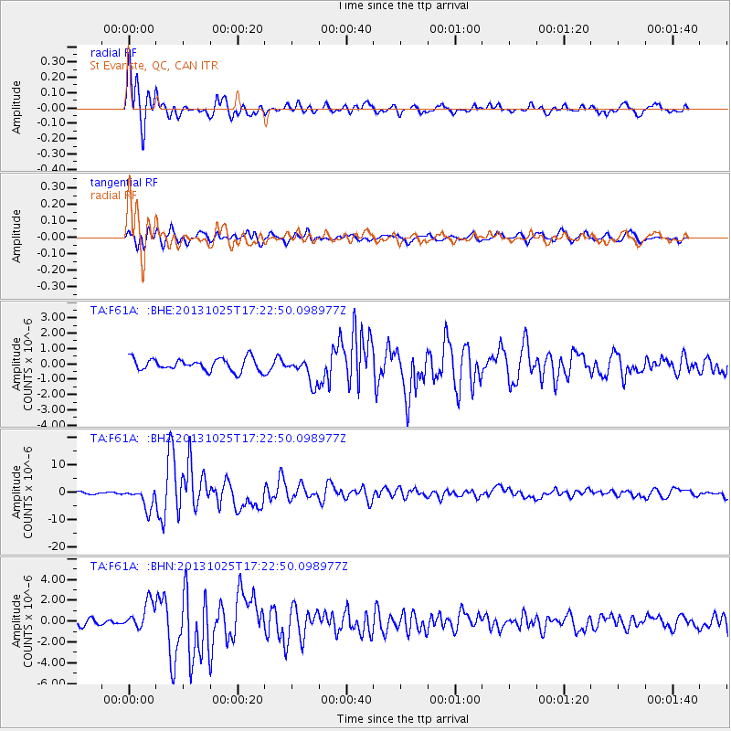
Earthquake location: Off East Coast Of Honshu, Japan
Earthquake latitude/longitude: 37.2/144.7
Earthquake time(UTC): 2013/10/25 (298) 17:10:19 GMT
Earthquake Depth: 35 km
Earthquake Magnitude: 7.1 MWW, 7.1 MWW, 7.1 MWB, 7.1 MWC, 7.2 MWC, 7.5 MI
Earthquake Catalog/Contributor: NEIC PDE/NEIC COMCAT
Network: TA USArray Transportable Network (new EarthScope stations)
Station: F61A St Evariste, QC, CAN
Lat/Lon: 45.97 N/70.99 W
Elevation: 350 m
Distance: 91.2 deg
Az: 23.991 deg
Baz: 332.238 deg
Ray Param: 0.04161153
Estimated Moho Depth: 41.25 km
Estimated Crust Vp/Vs: 1.78
Assumed Crust Vp: 6.419 km/s
Estimated Crust Vs: 3.611 km/s
Estimated Crust Poisson's Ratio: 0.27
Radial Match: 93.59093 %
Radial Bump: 400
Transverse Match: 73.61982 %
Transverse Bump: 400
SOD ConfigId: 626651
Insert Time: 2014-04-19 06:06:08.642 +0000
GWidth: 2.5
Max Bumps: 400
Tol: 0.001

Signal To Noise

ChannelStoNSTALTA
TA:F61A: :BHZ:20131025T17:22:50.098977Z7.0996233.76675E-65.305563E-7
TA:F61A: :BHN:20131025T17:22:50.098977Z3.09635971.3403812E-64.3288938E-7
TA:F61A: :BHE:20131025T17:22:50.098977Z2.11922298.503962E-74.0127736E-7
Arrivals
Ps5.1 SECOND
PpPs17 SECOND
PsPs/PpSs23 SECOND