
G45A Suttons Bay, MI, USA - Earthquake Result Viewer
| ||||||||||||||||||
| ||||||||||||||||||
| ||||||||||||||||||
|
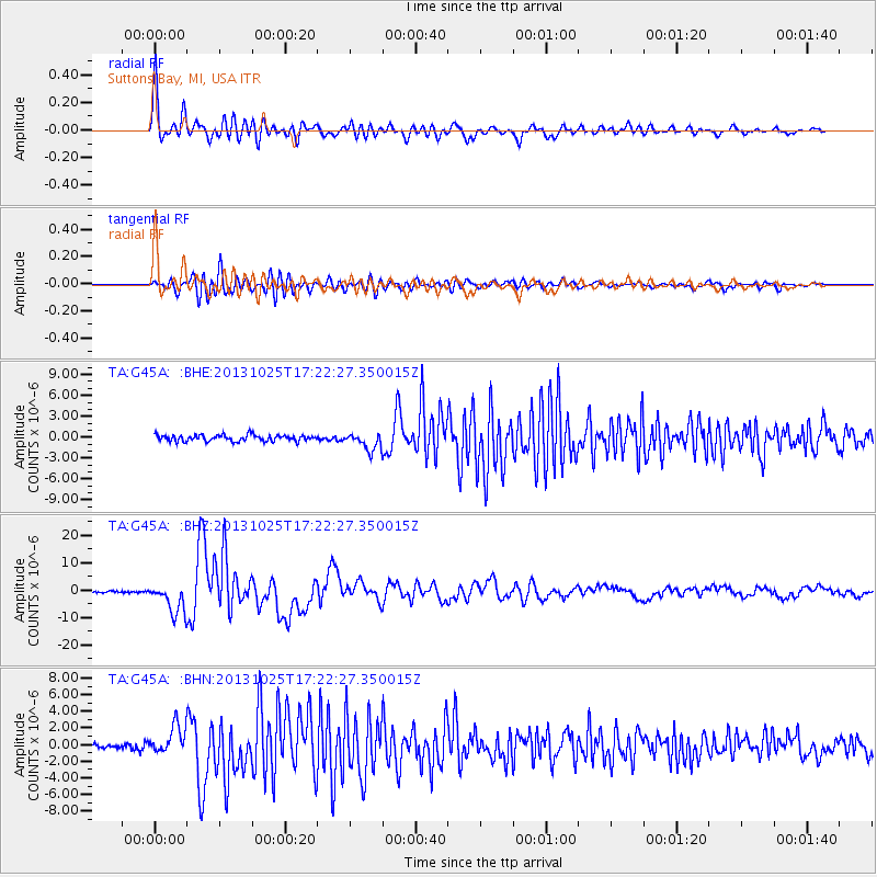
Signal To Noise
| Channel | StoN | STA | LTA |
| TA:G45A: :BHZ:20131025T17:22:27.350015Z | 13.115045 | 5.48697E-6 | 4.183722E-7 |
| TA:G45A: :BHN:20131025T17:22:27.350015Z | 5.4040084 | 1.640455E-6 | 3.0356264E-7 |
| TA:G45A: :BHE:20131025T17:22:27.350015Z | 2.6720617 | 1.2102349E-6 | 4.529218E-7 |
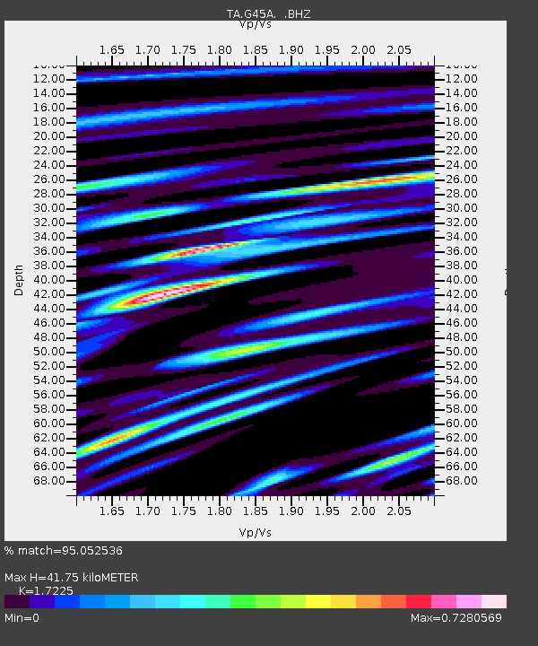
| Arrivals | |
| Ps | 4.8 SECOND |
| PpPs | 17 SECOND |
| PsPs/PpSs | 22 SECOND |

