
H04D Lebanon, OR, USA - Earthquake Result Viewer
| ||||||||||||||||||
| ||||||||||||||||||
| ||||||||||||||||||
|
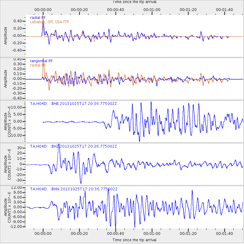
Signal To Noise
| Channel | StoN | STA | LTA |
| TA:H04D: :BHZ:20131025T17:20:36.775002Z | 47.811268 | 6.0359616E-6 | 1.2624558E-7 |
| TA:H04D: :BHN:20131025T17:20:36.775002Z | 5.1587114 | 1.4345206E-6 | 2.7807732E-7 |
| TA:H04D: :BHE:20131025T17:20:36.775002Z | 6.415334 | 1.3880801E-6 | 2.163691E-7 |
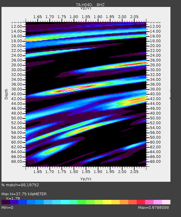
| Arrivals | |
| Ps | 4.7 SECOND |
| PpPs | 15 SECOND |
| PsPs/PpSs | 20 SECOND |

